Fieldwork Summaries
- Get Involved
- Remains of a Coprolite mine, Middle Cliff at Speeton
- Gillingwood Hall, Richmond 2024
- Excavation at Brompton-by-Sawdon 2023
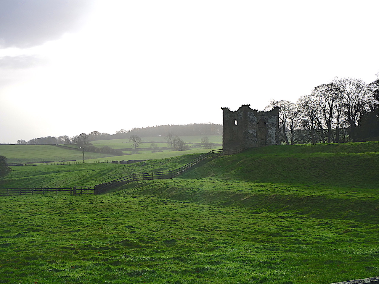
- Aldby Park, Buttercrambe Earthwork survey 2021-2023
- 100 Castle Road 2022
- Thorn Park Farm 2022
- Brompton Castle Hill Excavation 2021
- Raincliffe Woods Excavation 2021
- Aldby Park, Buttercrambe 2021
- Brompton Castle Hill 2019
- Scarborough Castle 2019
- The Forge site, Forge Valley 2019
- Brompton Castle Hill 2018
- Brompton Castle Hill 2017
- Raincliffe Woods 2016-2017
- Brompton Castle Hill 2016
- Hanging Grimston 2016
- Hanging Grimston 2015
- Cellar investigations at 32 Sandside
- Excavation at 3 Westbourne Park, Scarborough
- Falsgrave Upper Well House - further investigations
- Field to the East of Raven Hall Road, Ravenscar
- Archaeological Investigations at 60 - 62 Quay Street Scarborough ** Updated 17/08/2020 **
- Land at the rear of 34 Queen Street, Scarborough - 2011
- Pre-historic square enclosure at Racecourse Road/Seamer Moor, Scarborough - 2009
- Scarborough Marine Engineers
- A Pre-historic square enclosure at Racecourse Road/Seamer Moor, Scarborough
- Auborough Street - Scarborough: recent and future work
- Field work at Wansford - Autumn 2006
- Quay Street, Scarborough - Autumn 2005
- Falsgrave Park Lower Well House - Summer 2005
- The Pentecostal Church - Easter 2005
- Friargate, Scarborough - 2005
- The Springfield Excavation - 2004
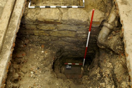
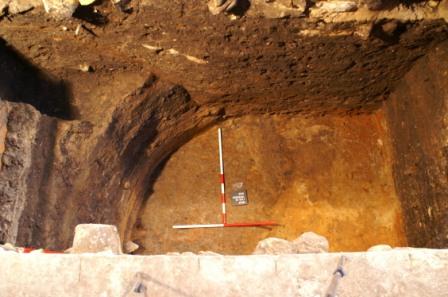
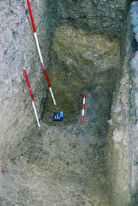
Remains of a Coprolite mine, Middle Cliff at Speeton
Following a cliff collapse at Middle Cliff, Speeton, towards the south end of Filey Bay in March 2023, some timber posts were revealed. These aroused some interest on social media, and were identified by a Society member as the remains of a mid-19th century coprolite mine.
A narrow bed of coprolite (about 12cms) outcrops at Speeton and for a short period in the mid 19th century this was worked by driving adits into the cliff. Coprolite is highly phosphatic and was an important resource in the production of early chemical fertilisers.
The Society decided to do a rapid recording of the remains which were likely to be lost due to further cliff erosion. There were four, possibly five pit props and one horizontal member. These were geo-located using, drawn, conventionally photographed and also 3D photographed. The horizontal member which had a turn in it appeared to be a re-used timber, from a ship possibly a second or third futtock making up one of the ribs of a ship’s hull. Any hopes of recovering this timber for further analysis were dashed when a further cliff collapse obliterated these remains
Further monitoring was carried out and in November 2023 another cliff collapse revealed a further four pit props which were also geo-located and photographed. These have also largely disappeared due to cliff collapse.
A fuller report is available here.
Gillingwood Hall, Richmond 2024
Gillingwood Hall, near Richmond in North Yorkshire, was a fine Jacobean mansion built by the Whartons, a gentry family who bought the manor in 1609. The original manor house burned down in 1750 and was replaced by a farmhouse. This report presents the results of an investigation of these buildings and their garden landscape which several members of the Society have been assistng with. For the first time, a rare example of an early seventeenth-century terraced garden, contemporary with the Jacobean house, has been recognised. A trial excavation undertaken in conjunction with the Society has located one outside wall of the early mansion and proved the existence of a previously unsuspected basement. A copy of the report on the garden remains and the search for the vanished manor house can be downloaded here
The early seventeenth century terraced garden at Gillingwood Hall viewed from the site of the vanished manor house.
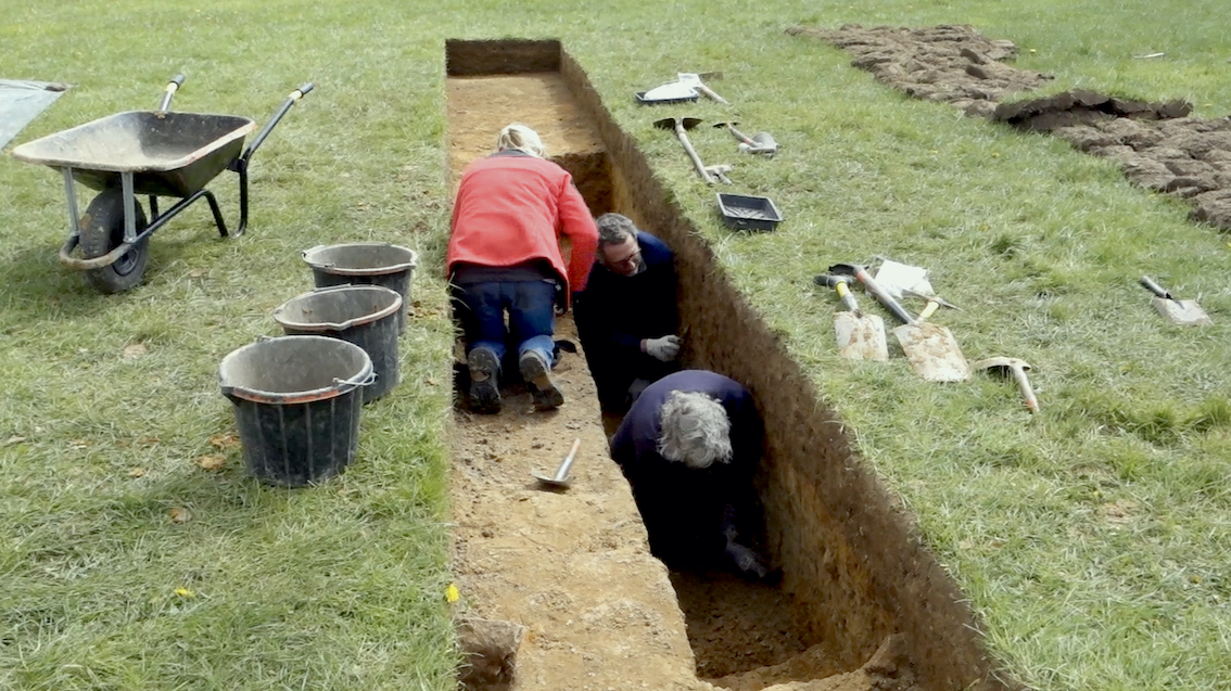
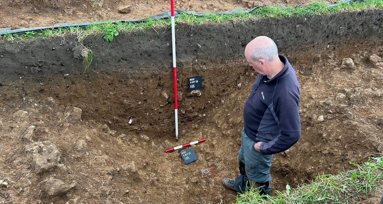
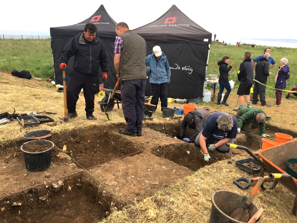
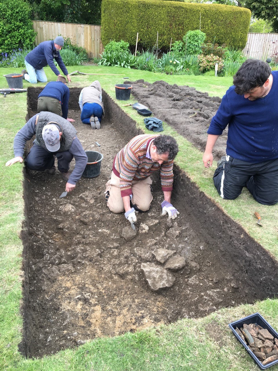
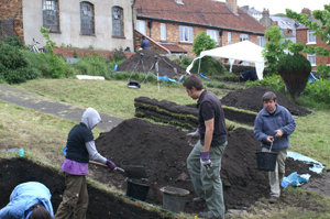
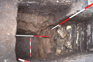
Excavation at Brompton-by-Sawdon 2023
Prior to 2023, the Society focussed its researches at Brompton on an area called Castle Hill where survey and excavation work over a number of years located several buildings and the perimeter wall of a medieval manor house. In July 2023 the Society undertook a series of garden digs to investigate the development of the village (report forthcoming). This was followed in October by the investigation of part of a cropmark site to the east of Brompton previously reported on by English Heritage. Three trenches were opened across across two ditches at the north-west extremity of a probable Roman settlement. The purpose of the excavation was to determine the nature and level of survival of the archaeological remains indicated by the cropmarks. The two ditches were aligned co-axially with one trench exposing the right-angle corner of an inner ditch while 16m to the north, the other two trenches examined different sections of an outer ditch. Both ditches had been backfilled rapidly resulting in a very uniform fill devoid of artefacts apart from one fragment of Roman roof tile and one sherd of pottery. Animal bone was also recovered, but the paucity of finds suggests that the area was very much on the periphery of the settlement. The excavation determined that in this area the settlement remains have been degraded by ploughing with only features cut into the natural likely to have survived. A copy of the report can be downloaded here.
One of the ditches excavated of all its fill
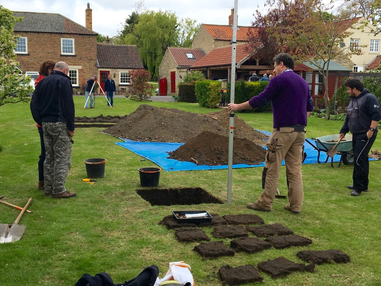
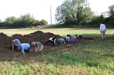
Aldby Park, Buttercrambe Earthwork survey 2021-23
This report presents the results of an analytical earthwork survey undertaken at Aldby Park, Buttercrambe, North Yorkshire between December 2021 and January 2023. Previously, in 2021, the two authors surveyed an undocumented motte and bailey castle in part of the gardens at Aldby Park. This report follows on from that earlier survey by delivering the first detailed account of earthwork remains across the remainder of the park. These include part of a deserted medieval settlement towards the centre of the park connected with a market area and earthworks belonging to the shrunken village of Buttercrambe to the south. The site of a probable medieval manor house was surveyed to the north of the present house while immediately beyond it an extensive, and well-preserved medieval field system of ridge and furrow was recorded. The survey also added detail to features connected with the designed landscape of the park dating to the 18th and 19th centuries. The report can be downloaded here.
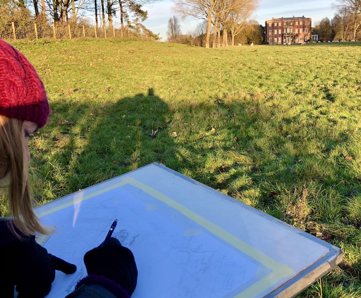
Earthwork survey in progress at Aldby Park, Buttercrambe in January 2022
100 Castle Road 2022
In February 2022 the owner of 100 Castle Road contacted the Society and draw our attention to the presence of a stone structure found within the ground floor during building works. The owner thought that the structure may be a fragment of the town wall. However, as the course of the Newborough defences in the vicinity of the site is well known to be on the opposite side of Castle Road, evidence being in both the surviving fragment of wall in the nearby car park and early mapping, it was clear that the structure could not be the town wall. However, it did appear, very unusually, to be a lime kiln within a building which is of interest so carried out investigations and survey. The Limekiln is probably late 18th century but in the early 19th century, after it had gone out of use a building was erected in front of it the kiln face being kept as a retaining wall.
We carried out 3D imagery and some of this showing the limekiln detail can be viewed at
https://poly.cam/capture/952B124B-35EE-42C9-8FF2-A6F4401A3D0F
Move your cursor over the image to rotate it
The full report can be downloaded here
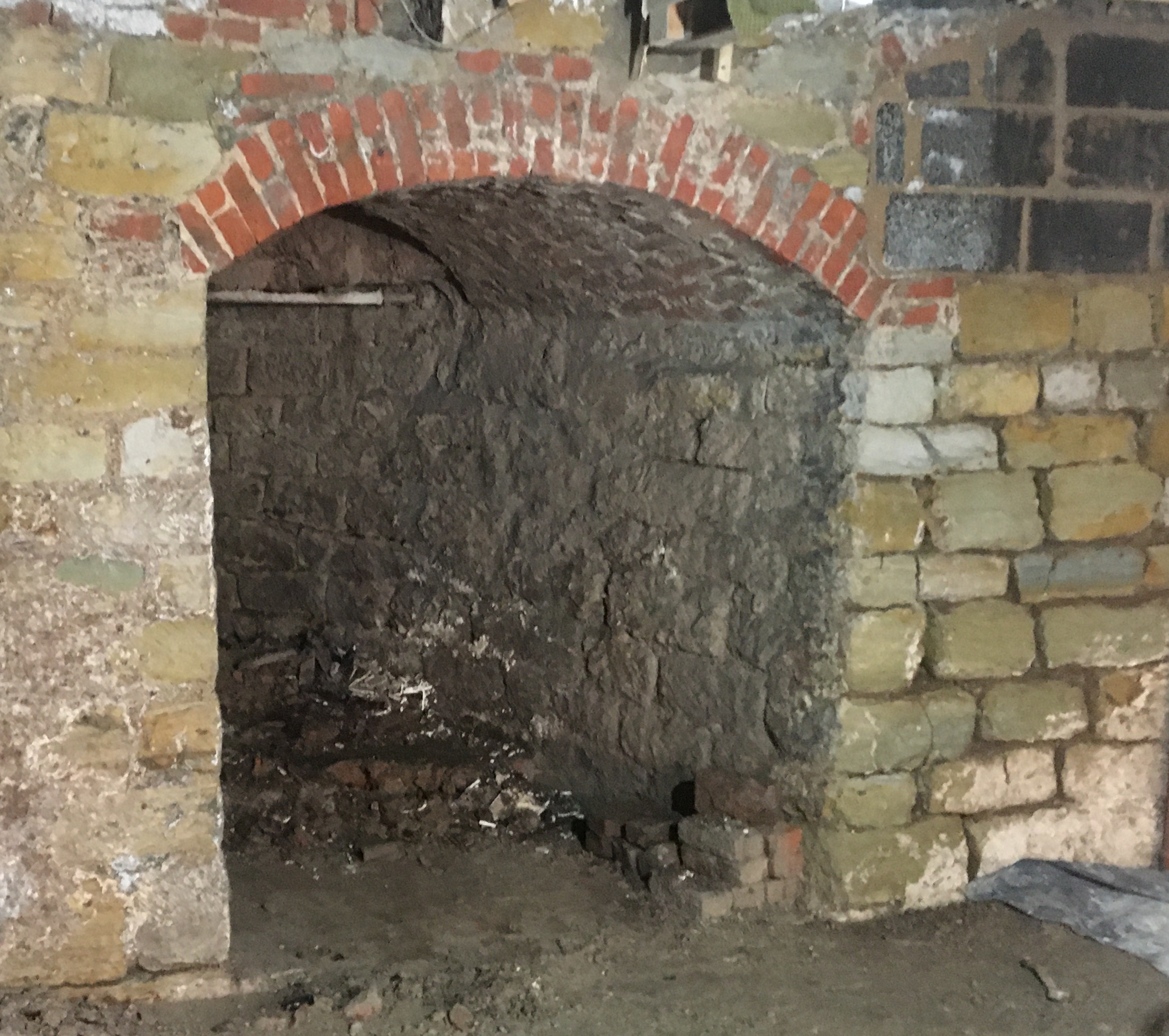
The kiln inside the Castle Road Building
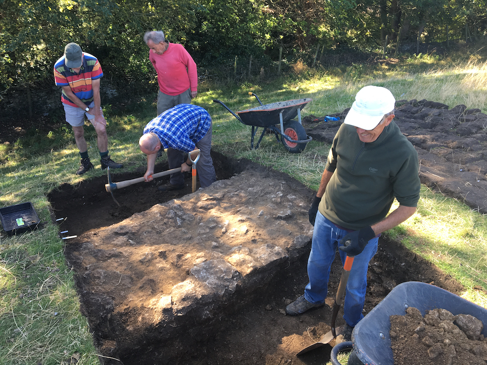
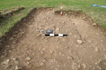
Thorn Park Farm 2022
Thorn Park Farm is several miles inland from Scarborough in the valley between Raincliffe Woods and Suffield Moor and south of the artificial drain called the Sea Cut that flows between the river Derwent and the coast at Scalby Beck.
With the encouragement and support of the farmer the Society excavated at the farm in 2022 to investigate two sites previously recorded from aerial photographs by Historic England. The project aimed to add to our understanding the landscape history of the area following an archaeological survey of the adjacent woods completed in 2018.
The first site investigated in April 2022 appears on aerial photographs as a parallel pair of ditches extending down the valley for 560m, possibly indicating the line of a former track. A previous geophysical survey by the Society located the two ditches on the ground and a 1m wide trench was excavated across each ditch. The width of the two ditches appeared upon excavation to be far greater than necessary to define the sides of a track. It is therefore possible that the feature could have begun as a double-ditch boundary, possibly of prehistoric date. This idea may gain support after a sample of the ditch fill has been radiocarbon dated.
The second site excavated in October 2022 appears on aerial photographs as a square enclosure about 25m across. The excavation discovered that the perimeter ditch is quite narrow with steep sides and a flat bottom and therefore may be a palisade trench as it is too narrow to have formed a practical defence or even to have confined livestock. No archaeological remains survived within the enclosure because of later ploughing.
The report on the 2022 excavation can be downloaded
here.
Excavating one of the ditches of the double-ditch cropmark.
View looking east along the valley with the excavation of the enclosure in progress
Brompton Castle Hill Excavation 2021
In September 2021 the Society’s field team excavated on Castle Hill in the village of Brompton-by-Sawdon about five miles inland from Scarborough. The discovery of several buildings and a strong wall facing out over the village in our previous excavations in 2017, 2018 and 2019 established that the hill is the probable site of a fortified medieval manor house.
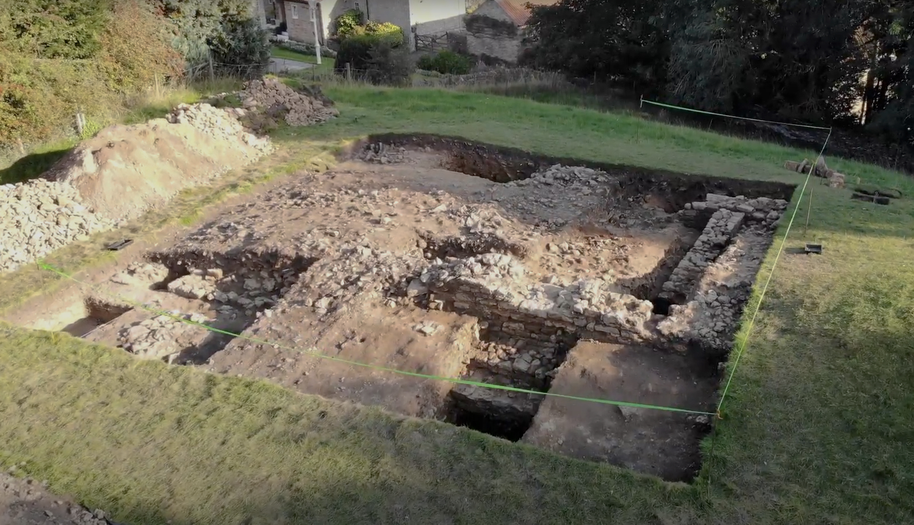
View of the excavated building looking south - note the extensive spread of demolition rubble masking the site (click on image to enlarge)
The 2021 excavation aimed to advance understanding of the manor house by exposing the major part of a single building indicated by earthworks and excavation evidence from 2018. The trench measuring 10m x 10m was easily the largest we had ever dug on the site and it revealed three sides of a stone-walled building from the middle ages. Measuring around 12m in length and 7m in width, the building had been roofed with stone tiles and from the thickness of the walls could easily have been two storeys high. With this height it would have been a prominent landmark standing on the south edge of the hill facing out over the Vale of Pickering. The walls had been badly robbed in places but enough survived to show the building had stone windows and architectural details picked out in fine ashlar masonry. Part of a second building was found at the north-east corner of the main building but with much narrower foundations suggesting it had a timber superstructure. The two buildings were abandoned, probably in the 14th century and allowed to partially collapse before final demolition which left an extensive spread of stone rubble over this part of the hill top.
The south side of the building being excavated (click on image to enlarge)
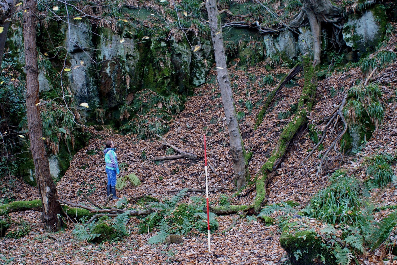
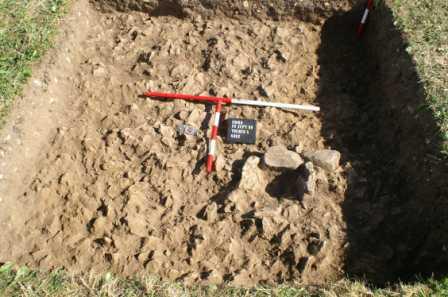
Raincliffe Woods Excavation 2021
In June 2021 an excavation took place to investigate a mound at Sawmill Bank Foot on the edge of Raincliffe Woods, Scarborough. The site was investigated as part of the Society's research into the evidence for iron working in the woods as surface evidence indicated the possibility this was a bloomery. The excavation uncovered a length of rough boulder wall associated with a shallow depression. Carbon 14 dating of a deposit of charcoal at the base of the depression next to the wall gave a middle Bronze Age date indicating that the feature is a rare survival from prehistory though its function has still to be determined. Sampling of the rest of the mound coupled with other archaeological finds indicate charcoal burning and iron working may have taken place in the vicinity but further archaeological investigations are needed to establish the exact circumstances. A copy of the report can be downloaded by clicking here.
The boulder wall being excavated (click on image to enlarge)
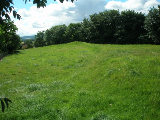
Aldby Park, Buttercrambe 2021
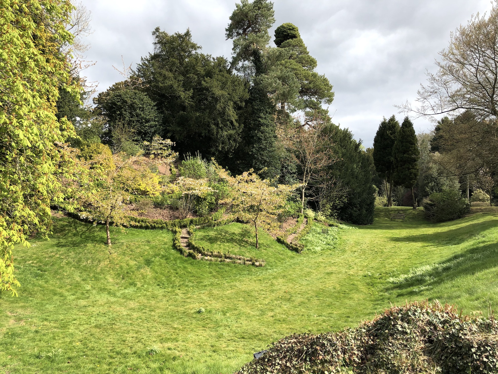
In April 2021 two members of the field team made a detailed survey of a garden feature in the grounds of Aldby Park, Buttercrambe in support of research into the history of the estate being undertaken by the Yorkshire Gardens Trust. The estate is the private residence of Mr and Mrs Winn-Darley whose ancestor, William Darley, moved there in 1557 from Wistow, near Selby.
Partly fringed by a wide, flat-bottomed dry ditch, the garden feature occupies the top of a steep slope overlooking the river Derwent. It is an elongated mound about 80m long with rounded peaks at either end while a series of garden terraces step down the valley side to the river below. The monument is planted with trees and ornamental bushes which largely obscure it from view and include several yews that from their girth must be a couple of hundred years old. The earthwork has been part of the gardens for nearly 400 years as it appears on the earliest map of the estate of 1633 with very much the same arrangement of paths and walkways that it has today.
The survey results indicate that the garden feature was created from the earthworks of a Norman motte and bailey castle probably in the late 16th or early 17th century when it was believed the site was the residence of King Edwin, the first christian king of Northumbria who died in battle in 633 AD. Although there is no evidence to support the link to King Edwin as first recorded by the Tudor antiquarian William Camden, it is possible that the motte incorporates the remains of a prehistoric burial mound. A copy of the report can be downloaded here.
Brompton Castle Hill 2019
The field team returned to Brompton Castle Hill in September 2019 to resume its investigations into the medieval remains discovered in the first season of work the previous autumn. The 2018 excavation established that earthworks visible in a pasture field on the west side of Castle Hill preserve the remains of a medieval structure towards its south side and a massive stone wall on the western side overlooking the village. The 2019 excavation advanced understanding by revealing a further section of the stone wall south-east of the 2018 trench and several buildings towards the centre of the site. It now appears very likely that the remains belong to an important medieval residence, most likely a manor house set apart from the rest of the village behind its own enclosure wall. The pottery from both the 2018 and 2019 excavations shows that the site probably dates to the 13th and 14th centuries when the Vescy family held much of the village so it is possible that the excavated remains are part of a manor house belonging to the family, though it will probably never be possible to prove this association with the Vescys beyond reasonable doubt. It is also possible that the site was fortified earlier in the medieval period with the construction of an earthwork motte and bailey castle of which part of the motte is thought to survive as a mounded area among the earthworks but this has yet to be tested by excavation.
The work on Castle Hill which also involved geophysical and earthwork surveys and a dig in an adjacent garden, has done much to establish the importance of the site in the medieval period and led to some ideas of how the village developed next to it, including the identification of a possible market area under the shadow of the manor house on the hill top. The work has benefited a great deal from the interest of the villagers and the support of members of the Brompton Local History Society. A copy of the 2019 report is available to download by clicking here.
Excavating a section of the wall enclosing the medieval manor
Scarborough Castle 2019:
Over two long weekends in the early summer of 2019 the fieldwork team worked with the English Heritage Trust to undertake a small excavation in the grounds of Scarborough Castle. The aim of the excavation was to test the idea that a large flat-topped mound in the outer bailey of the castle is a dump of spoil from an abandoned plan to construct a large playing field in 1926. The excavation determined that the mound is probably of two phases beginning with a spoil dump from the 1921-5 excavation of the Roman Signal Station which was then added to in 1926 with spoil from levelling the north end of the playing field. That this levelling work disturbed an area of prehistoric deposits is indicated by the small assemblage of Iron Age pottery recovered from the 1926 mound. Other more recent artefacts shed light on the long use of the headland for military training including a concentration of finds from the 1940s and 50s found in a pit dug into the side of the 1926 mound.
As well as the dig, the Society also arranged activities for children with the ‘mini-digs’ proving very popular and there was someone on hand at all times to talk to the visitors about what we were doing. Over the course of the six days of the dig nearly 800 people came to visit the excavation. It also featured in the local paper and radio and on the BBC Look North regional news programme. A copy of the report on the excavation can be downloaded using this link.
The excavation in progress
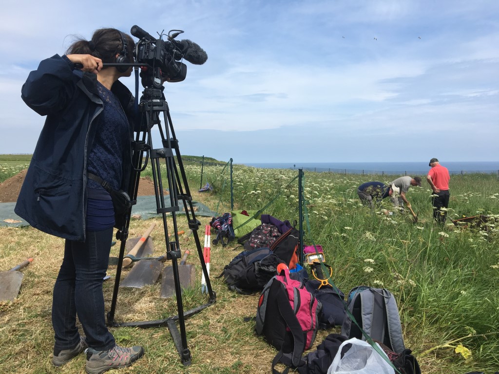
Filiming by the BBC
The Forge site, Forge Valley 2019:
In the spring of 2019 members of the fieldwork team undertook the first detailed investigation of the site of the 18th-century forge in Forge Valley (link here). The work followed on from the Society’s 2016-7 project surveying the archaeology of Forge Valley, Raincliffe and Row Brow Woods (link here). One of the results of that earlier project was the identification of over 30 earthwork platforms, many of which may have been for burning wood to make the charcoal needed at the forge. It was therefore decided o take a closer look at the site of the forge which involved doing a 1:500 scale survey of the visible remains, taking cores to sample the deposits below one part of the site and documentary research at archives in Leeds, Sheffield and Beverley.
The research has identified the locations of three buildings which may have been part of the forge in the 18th century which stood on the east side of the river Derwent about 500m from the north end of Forge Valley. Nothing much remains to be seen of these buildings but more probably survives below ground. The documentary research shows what an important part the forge played in the development of the iron working industry in the north in the 18th century.
Brompton Castle Hill 2018:
At the end of September 2018 the fieldwork team returned to Castle Hill on the east side of the village of Brompton-by-Sawdon to investigate the earthworks in the pasture field on the west side of the hill. The field is protected by Historic England as a Scheduled Ancient Monument as the earthworks are believed to be the remains of the medieval fortified site indicated by the name of the hill. We surveyed the earthworks in 2016 (link here) but could find no evidence that they belonged to a castle but the following year we excavated part of a building and cobbled yard in an adjacent garden indicating there may have been some important medieval buildings on the hill top after all (link here).
With the permission of Historic England, the land owner and the tenant farmer, we excavated four small trenches in various parts of the field to try and date the earthworks and see if any medieval remains survived on the site like those we found in the next door garden in 2017. In the event the results surpassed our expectations (link here). One trench on the crest of the hill overlooking the village unconvered a massive 1.5m wide and 1m deep stone wall built on a raft of stone slabs. The wall dates to the medieval period and is so strongly constructed that it must once have stood many metres high. We have yet to prove that it continued right around the hill top but this may be the first archaeological evidence to support the local tradition of a castle on the site. Also on the edge of the hill, but further to the south, a second excavation trench uncovered the stone foundations of parts of several medieval structures buried beneath a promiment mound of rubble. Contained within the mound were several fragments of worked stone including a section of column and part of an arch of a medieval two-light window. These must have come from an important, high-status stone building which adds further support to the idea of a medieval castle on the site. Two other trenches elsewhere in the field did not reveal anything as important but overall we are confident that we have found an important medieval site which could well be the castle suggested by the name 'Castle Hill'. We hope to return to do more work in 2019.
The medieval stone wall on the edge of Castle Hill
Brompton Castle Hill 2017:
Excavation at Castle Hill, Brompton by Sawdon
In early May 2017 the fieldwork team excavated two trenches in a garden next to the pasture field surveyed in 2016 as part of its continuing research to discover more about the archaeology of Castle Hill in Brompton by Sawdon. The excavation revealed that buried below the garden are the remains of a medieval building. We found what we think is one corner of the building which seems to have had stone foundations suggesting it may have been more than one storey high. On the inside of the building we found where sandy mortar has been laid to provide a level surface for a floor though none of the actual floor survived. On the outside of the building we discovered a yard surface composed of a spread of small pebbles and some larger stones rammed into the ground. We did not have time to investigate the building or the yard in too much detail but the pottery we found indicated these features date back to the medieval period, around six or seven hundred years ago. The finds also included fragments of glazed roof tile which is a very rare find and suggests whatever the building was it must have been roofed with expensive ceramic tiles rather than stone slates or thatch.
It is too early yet to say that we have found the actual castle commemorated by the name ‘Castle Hill’ but as a result of the excavation we can be sure that at least one important building stood on the hilltop in the middle ages. We dug a second small trench in another part of the garden to see if we could find more of the yard or the building but all we found was stone rubble presumably spread from the demolition of the building. An unexpected discovery by one of the eagle-eyed archaeologists was a tiny piece of worked flint called a microlith which dates to the Mesolithic or Middle Stone Age period around 9,000 years ago. We also found a flint core in the same trench which is the raw material from which pieces of flint were struck to make tools.
The archaeology team hopes to return to Brompton in the near future to resume its search for the medieval castle by digging elsewhere on Castle Hill though there is no guarantee that any future dig will find such spectacular remains as we unearthed on this site.
The following photographs show the excavation in progress...
A more detailed interim Report on the work carried is available by clicking here.
Raincliffe Woods 2016-2017
Survey of Raincliffe, Row Brow and Forge Valley Woods 2016-17
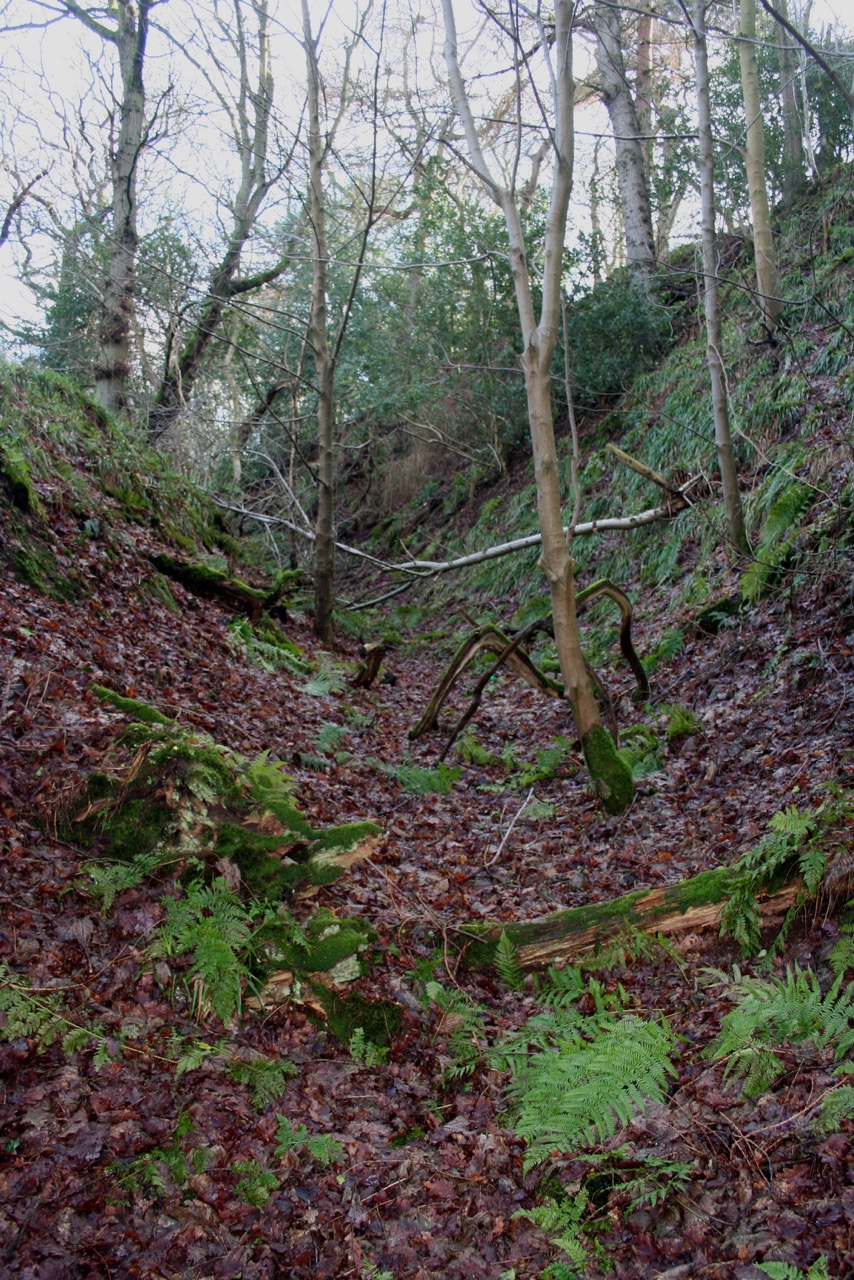
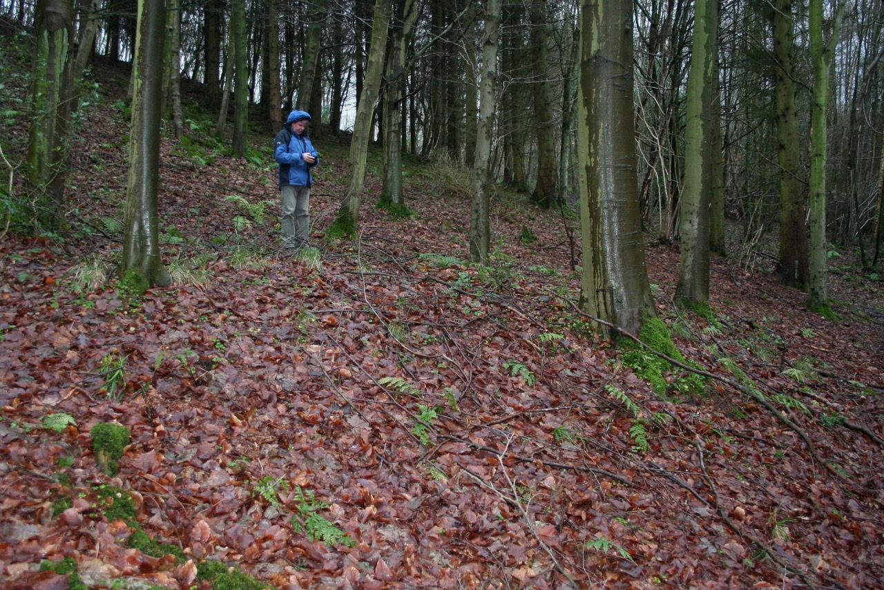
Over the winter months of 2016 and 2017 the Society has been working in Raincliffe, Forge Valley and Row Brow Woods making the first detailed record of their archaeology. The woods form a continuous belt nearly five miles long extending from East Ayton to Stepney Hill and cover the steep west and north slopes of Seamer, Irton and East Ayton Moors. Using the Society’s newly-acquired GPS mapping receiver, members of the Society’s fieldwork team have been systematically mapping all features of archaeological interest visible among the trees and which potentially range in date from prehistoric times to the last century.
One of the most unexpected features of the survey has been the large number of disused tracks which survive among the woods, many of which have formed deep hollow ways where they cross the steepest parts of the slope. Many of the hollow ways are so deeply eroded they must have been in use for centuries and probably by livestock as well as people moving between the high moor tops and the valleys leading to Scalby and Hackness. In several places there are several hollow ways in close proximity suggesting that routes periodically changed alignments as existing tracks became impassable.
Also preserved in the woodland are around 20 small circular platforms made by cutting into the hillside at the back and piling up material on the front to create a level area. As yet the field team are not sure what these were used for and how old they are, but most likely is that some of them were created to form level areas for bonfires for making charcoal. Selective burning of timber to make charcoal has been an important woodland industry for many centuries and in these woods may have been connected with the production of charcoal for the iron-making forge at the north end of Forge Valley which was in operation during the closing decades of the eighteenth century. It is also possible that other platforms mark the locations of small buildings or animal pens, but further work is needed before we can be certain what they were used for.
The fieldwork has also mapped extensive areas of quarrying, particularly on the slopes above Throxenby Mere where the rock face called Cock Hollow quarry is just part of a much more extensive area of quarrying indicated by tree-covered pits and hollows. It is likely stone was taken from this area for building material whilst smaller quarries recorded elsewhere in the woods may have been for field walls or for lime burning.
A final report has been published on the survey work (link here) and now the Society is concentrating its effort to lean more about the 18th century forge and how the iron working industry impacted on the woods. This involves detailed survey work of the forge site and the possible charcoal burning sites and documentary research into local archives. A report on this new phase of research will follow.
CAPTIONS
1. An example of one of the deep hollow ways found throughout the woods
2. The figure stands on a slight platform close to the Green Gate car park
3. Exposed rock face forming part of Cock Hollow quarry
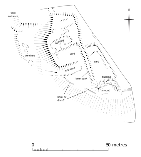
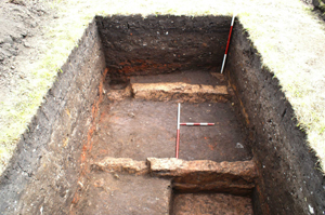
Earthwork Survey at Castle Hill, Brompton by Sawdon 2016
In April 2016 members of the Scarborough Archaeological and Historical Society surveyed the earthworks surviving in a pasture field forming part of Castle Hill on the east side of the village of Brompton-by-Sawdon. The work followed on from a geophysical survey of the field undertaken in 2014.
Castle Hill is a natural spur formed by limestone bedrock and gravel which rises steeply on the south and west sides but on the north and east it is far less pronounced as it merges into the general south-facing dip slope of the Tabular Hills. The hill would probably have formed quite a distinctive landmark viewed from the lower ground to the west and south before the expansion of the village of Brompton. Castle Hill receives passing reference in several local guidebooks in the 19th and 20th centuries but these sources do not add any substantial information. However, large scale Ordnance survey mapping published in the late 19th and early 20th centuries show a series of linear and sub-rectangular earthworks in the field which broadly match those recorded in the present survey.
The earthwork survey mapped a small rectangular building with an associated yard to its south with a route leading into the yard from the west. The survey also recorded a possible second building further to the south though this is not necessarily the same date as the complex to the north. A north-south bank overlying the yard suggests a later arrangement of field boundaries presumably after the yard had fallen into disuse. There is no evidence to securely date either of the two buildings though a medieval or early post-medieval date seem the most likely and they probably had an agricultural purpose with the yard used for livestock. However this is not to discount the possibility that more impressive buildings stood elsewhere on the hilltop and have now been lost explaining why this part of the village is called ‘Castle Hill’. A more detailed Interim Report is available on the work carried out so far [here is a link to the report]. The society is planning to return to the site to undertake test excavations to try and find evidence for medieval occupation on the hilltop.
CAPTIONS
1. General view across the field looking south
2. Earthwork survey plan
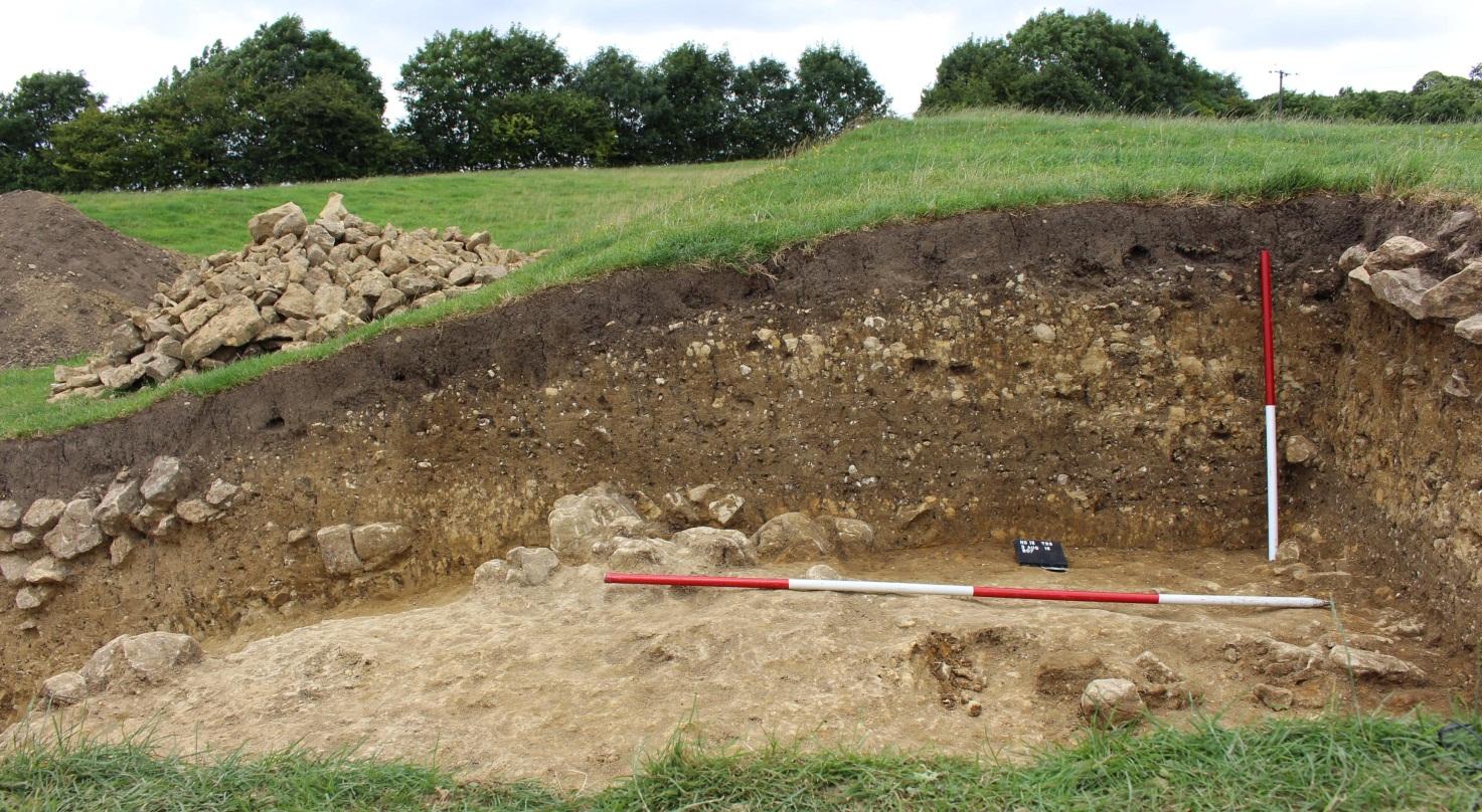
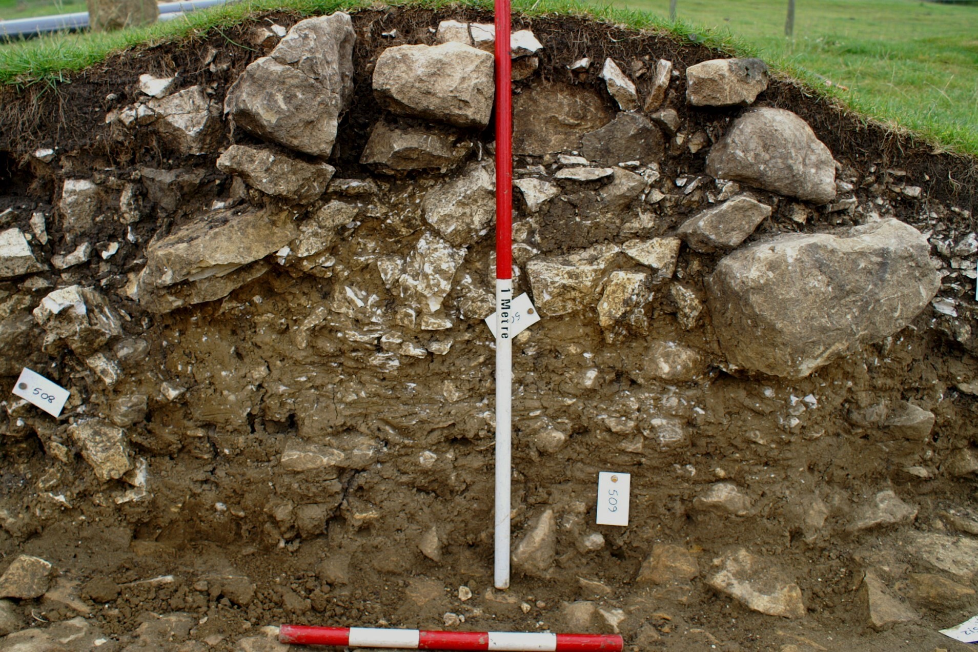
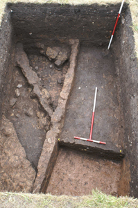
Hanging Grimston 2016
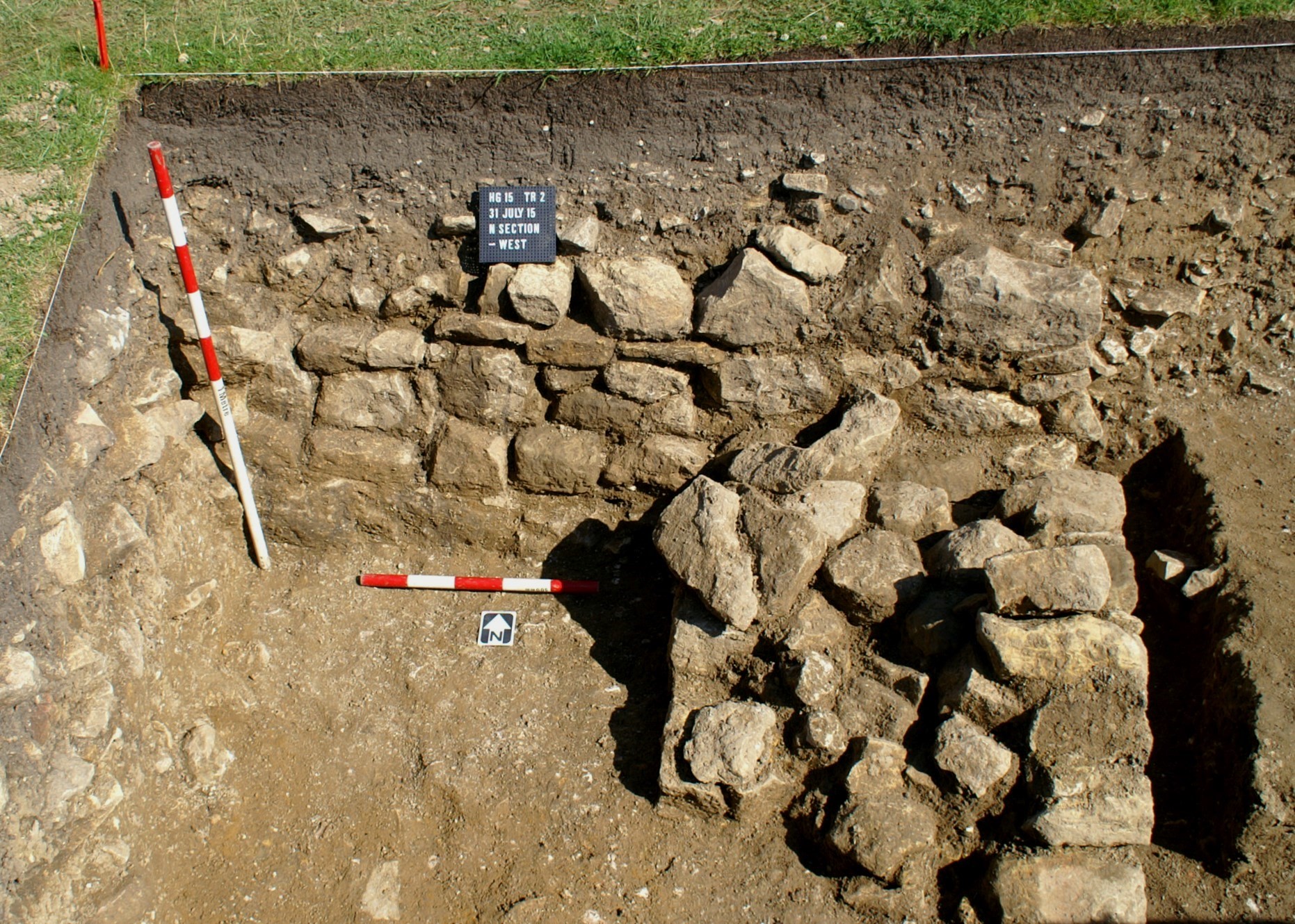
This year three trenches were excavated. Two trenches from last year, no. 2 on the eastern boundary of the manorial enclosure and no. 5 on the site of a large, post-medieval, C-shaped house, were re-opened and extended in order to excavate them fully down to natural deposits at the same time as investigating more of the features within. One new trench (Trench 6) was also dug to investigate the character of the western boundary of the manorial enclosure.
Trench 2
We now know that the earliest feature within Trench 2 is a deep ditch (its base lying circa 1.7m below the modern ground surface) aligned roughly north-south. This has a W-profile, presumably indicating it silted and was then recut. It is currently undated, but we believe it to be Roman or even prehistoric. In the 12th century, long after the ditch had completely silted and been forgotten, a pebble surface was laid over the natural chalk bedrock in the east end of the trench, extending over the ditch. This may have been a yard area, although if so, it was not in use for long before the eastern boundary wall of the manorial enclosure was constructed across it. We have also found a number of other walls within the enclosure, but at present their relationship to each other and the manorial boundary is unclear; one of these was also constructed across the silted ditch and must have begun to fall down for a buttress was subsequently added.

Trench 2 showing the large W-shaped ditch closest to the camera
Trench 5
Trench 5 was started in 2015 to investigate the remains of a large C-shaped building overlying, and therefore later than, the main medieval village earthworks. At the end of last year’s excavations we discovered documentary evidence that suggests the building is in fact the mansion house of John Bourchier, second son of Sir Ralph Bourchier of Beningborough Hall. Sir Ralph bought the Hanging Grimston estate in 1575 specifically for John and his wife. In 2016 Trench 5 was emptied of backfill, extended by a metre or so to the south to expose more of a (presumably medieval) stone wall found last year below the robbed-out remains of the Bourchier mansion, and excavated down to natural across the whole area of the trench.

Trench 5 showing the medieval foundation wall
At the deepest levels in Trench 5, underlying both the Bourchier mansion and medieval wall, a number of features were found cut into natural which here is not chalk but a clayey solifluction deposit overlying Whitwell Oolite. Several of these cut features contained what looked to be Roman pottery and very likely relate to an Iron Age/Romano-British ‘ladder settlement’, which geophysical survey has suggested lies under the eastern edge of the medieval village. Later, in the medieval period, a stone building was constructed of which we have found a stretch of the southern wall: we know this because a doorway in the wall has rebates in its northern side marking the position of a former timber (internal) doorframe. This building was in turn succeeded by the Bourchier mansion whose basic plan is traceable on the surface as a series of earthwork banks. As the excavations progressed last year, it became apparent that the earthwork we were sampling within the trench was in fact an upcast bank of spoil from a robbed-out wall line that lay immediately to the west. The actual robber trench was only seen with difficulty last year, but was much more apparent in the southern extension to the trench this year. Unfortunately the robbing has been comprehensive and no floor levels survive. The form and quality of architectural stone fragments (door mouldings, window mullions, etc) and fragments of window cames (lead strips) recovered from the demolition rubble, however, are indicative of both a 16th/17th-century date for the building and it being of relatively high status, thus seeming to corroborate our identification of it as the documented Bourchier mansion.
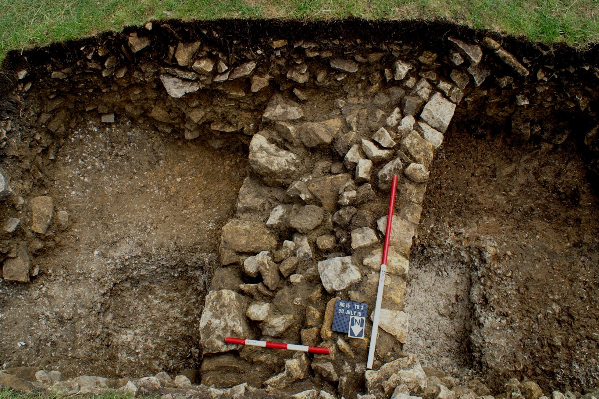
Trench 6
Trench 6 was a new trench this year, positioned to sample a point on the western boundary of the manorial enclosure where earthwork evidence indicates it is met by an internal east-west scarp-cum-bank. Before excavation we took the scarp representing the manorial boundary to be the remains of a ruined wall. However, where sampled by Trench 6 the boundary was found to consist solely of an earthen bank overlain by a deposit of yellowish, more stony, material (probably upcast natural), and with a broad ditch or possible routeway on its western (outer) side. The bank is low and broad suggesting it may have originated as a plough ridge; if so, it indicates that the manorial enclosure is laid out over former cultivated fields and post-dates the founding of the village. The east-west scarp running away at right angles from the enclosure boundary proved to be the downhill edge of the upcast natural - seemingly a levelling deposit associated with terracing the hillside within the enclosure to create level platforms for buildings.
The north section of Trench 6
Text Marcus Jecock
Images Chris Hall
Previous Excavations
Hanging Grimston 2015
The Hanging Grimston Community Archaeology Project is a joint venture of the High Wolds Heritage Group and Scarborough Archaeological & Historical Society. Its principal aims are:
- to test ideas about the phasing and history of medieval and earlier settlement remains at Hanging Grimston derived from previous earthwork and geophysical surveys;
- to set the knowledge so gained against the wider picture of landscape development in the Yorkshire Wolds; and
- to build up a body of archaeological and historical research skills amongst the local population.
Four out of a planned five trenches were excavated over a two-week period at the end of July 2015, although none was excavated completely to natural subsoil. Where major stone walls were encountered, these have so far been left in situ and so are not securely dated.
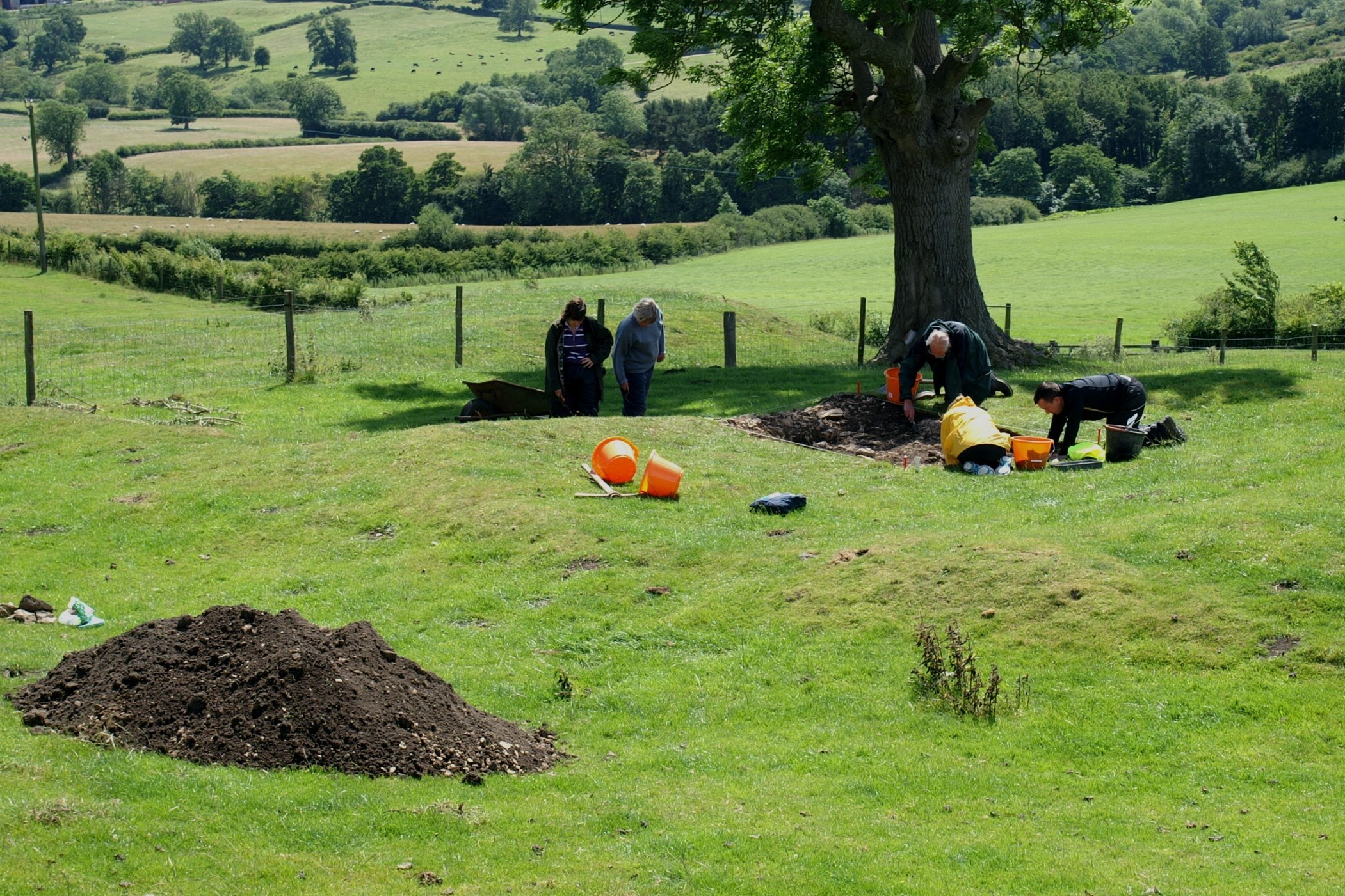
General view of part of the site – trench 5 in progress
Trench 1 was located to retrieve dating evidence from one of the ditches of a ploughed-out ‘ladder settlement’ known from geophysical survey. The ditch, dug into Oxford Clay, was found to contain sherds of late Iron Age and Romano-British pottery, several of substantial size.
The ditch in Trench 1
Trench 2 was opened to explore what was thought to be the ruined boundary wall of a large, sub-rectilinear enclosure, probably manorial in nature. Excavation showed that within the area of the trench the boundary wall, if it ever existed, had been completely robbed away. However, a well-preserved wall, as yet undated but probably medieval, located at the western end of the trench is either the corner of a building or the revetment of a building platform terraced into the hillside.
The wall at the western end of Trench 2
Trench 3 was dug to investigate a penannular earthwork in the northern half of the presumed manorial enclosure. A curving stone wall some 0.9m wide and standing several courses high was duly located. The feature is currently interpreted as a medieval dovecote.
The curved wall in Trench 3
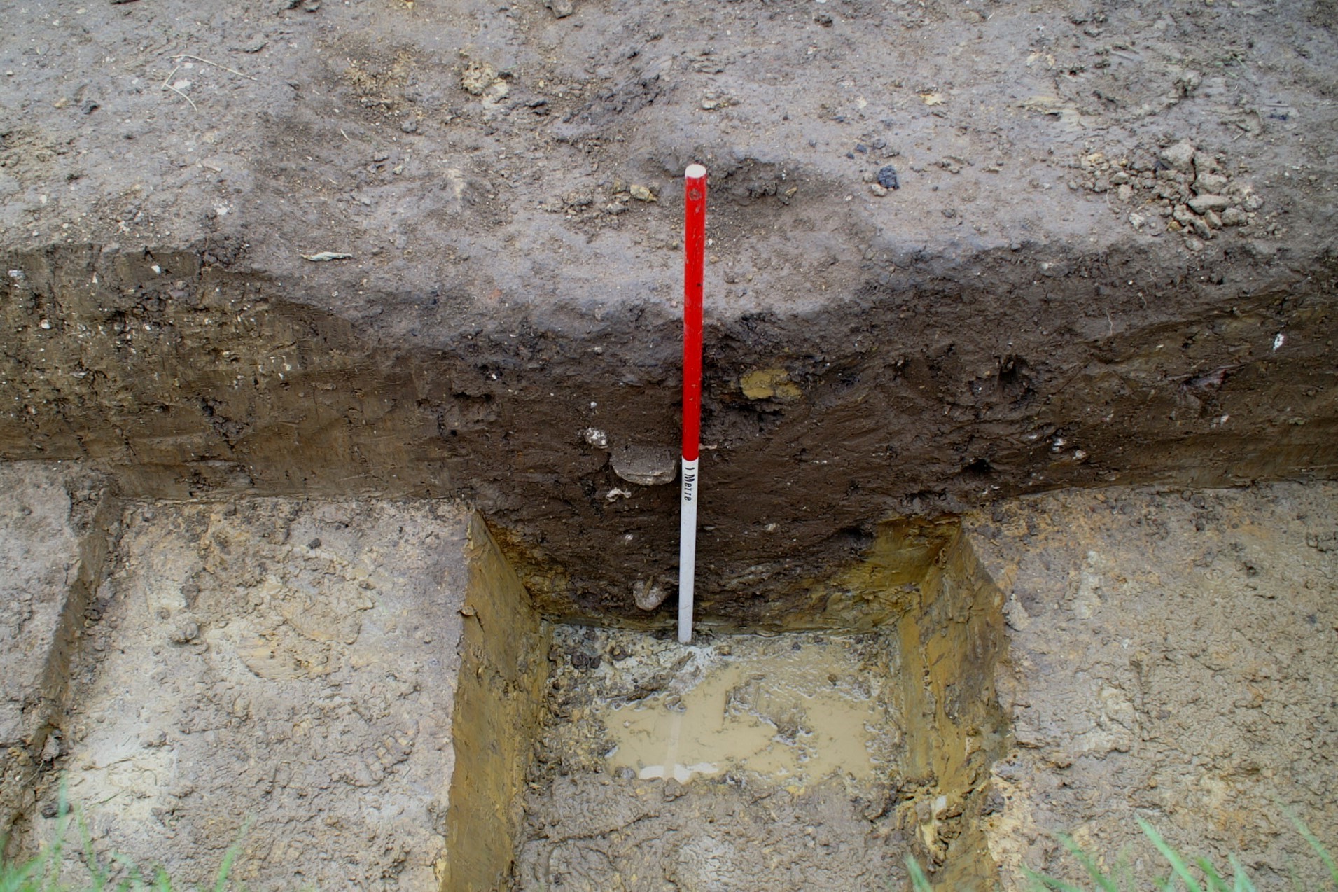
Trench 5 was positioned to explore a large C-shaped building that earthwork evidence suggests overlies, and therefore postdates, part of the medieval village. As in trench 2, excavation indicated that much of what had been interpreted from earthwork evidence as a buried wall line was rather debris from stone robbing. The footings of a wall were revealed at right angles to the robbed wall, but further excavation is required to determine if this is part of the C-shaped building or an earlier structure.
Section through the earthwork in Trench 5
The project would like to thank the tenant farmer (Mr Ian Grice), the landowner (the Halifax Estate), Historic England and Natural England for permission to excavate. The dig was part-funded through the Council of British Archaeology’s Mick Aston Fund.
Text - Marcus Jecock
Images - Chris Hall
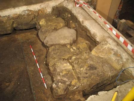
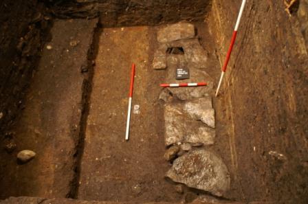
Cellar investigations at 32 Sandside
32 Sandside is part of a large brick built block containing numbers 32, 33 & 34 Sandside dating from the early part of the 18th century. During restoration of the building in 2000 the Society carried out investigations in the cellar of number 33. We revisited the site in October 2013 to record the cellar of number 32. It was found that the spine wall, which is shared with number 33, at this point consisted of stone masonry, unlike the situation found in 2000 where 18th century brick was built off stone masonry. However both this spine wall and the brick cross wall at right angles to it appeared to be built off clean sand though one piece of medieval pottery was found. It may be the case that as at number 33 this is a late medieval build-up of sand.
However in the south east corner a substantial stone structure of large coursed and well-dressed stones was seen, illustrated below
Feature F12 in the south east corner
This is clearly a much earlier structure since the sand was butting against it and it may have been built off an earlier beach level. The exact function is at present is unknown but it may relate to the development of the Quay as this building may be one of those which had its own pier. The brick cross wall joined the stone spine wall with a straight joint so it is still thought likely that the masonry predated the 18th century brick building.
A survey of the beams supporting the floor above the cellar was made. Many beams showed evidence of re-use from either an earlier building or a ship.
View looking east of beams 8 (the short one) and 2 & 3 showing evidence of re-use. The eastern ends of the beams sit on the masonry spine wall. The cross wall of 18th Century brick is on the left
Excavation at 3 Westbourne Park, Scarborough
In 2001 the Society started a test pitting project in Falsgrave to try to locate remains of the medieval village which, at the time of the Domesday survey of 1086, was the most important settlement in the district. A total of 13 sites were test pitted in 2001 and a further seven test pits were excavated by the Society and members of the public as part of the ‘Falsgrave big dig’ in 2005.
In September 2010 the opportunity arose to carry out another test pit in the back garden of 3 Westbourne Park where a single trench measuring 5 metres long by 2 metres wide was excavated alongside the boundary wall between 3 Westbourne Park and 6 & 8 Seamer Road, aligned north-south. Undisturbed natural clay was encountered at a depth of 0.95 metres, though it became apparent that this represented the bottom of a shallow ditch, the cut of which was exactly under the western edge of the trench. Widening of the excavation trench to 2.2 metres at each end revealed that beyond the edge of the cut, natural clay lay at a depth of only 0.45 metres below the present ground surface. The ditch feature was flat bottomed and neither the eastern, northern nor southern edges of it were found.
Northern end of the trench showing the cut into the natural alongside the vertical scale and the fill of the ditch
This feature was filled by a fine to silty stiff clay/loam which was grey with dark brown streaking and which had apparently filled the ditch in two phases, the first phase having a smaller amount of brown streaking. This fill material, contexts 12, 14 and 18, had clearly been deposited over some time and was water borne. It contained fragments of pottery of the Roman, medieval, post medieval and modern (post 1700) periods, the latter confined to context 12. Some of this pottery was highly abraded, particularly in the higher context 12, indicating that it had been turned over within the plough soil over many years.
Both the natural clay to the west of the ditch and the fill material 12/14/18 were topped by layers of stiffer orange to mid brown clay containing mortar and charcoal inclusions (contexts 10 and 11). These layers contained post medieval and 19th century pottery and were interpreted as spread and trample layers from the building of the nearby houses in the third quarter of the 19th century. No relict field surface was found between the spread and trample layers 10 and 11 and the lower fill layers, and it is assumed that the top soil had been cleared before the erection of the houses.
No positive conclusions were drawn as to the use of the ditch, however the fact that it is relatively shallow (500mm), flat bottomed and at least 2.0 metres wide seems to indicate that it was a clay pit or quarry. There is no evidence of it having contained a robbed out wall.
Whilst the other test pit excavations in the Falsgrave area have revealed the presence of medieval pottery, this is the only test pit to have a structure of any sort. Since the Roman pottery was mixed with medieval, post medieval and modern pottery, no particular significance can be ascribed to it other than that it has been brought into the site as a result of the infilling of the ditch. The Roman pottery had also been abraded due to being in the plough soil.
Falsgrave Upper Well House - further investigations
 The area occupied by modern Falsgrave Park was important to the development of the medieval town as it was the location of springs tapped by the Franciscan Friars to provide a water supply for both themselves and the townspeople.
It is known that the Fransciscans first tapped the springs in 1319 when they built a pipe to supply the lower, middle and upper ‘conduits’ in what we now call the Old Town. They reinforced the supply 20 years later.
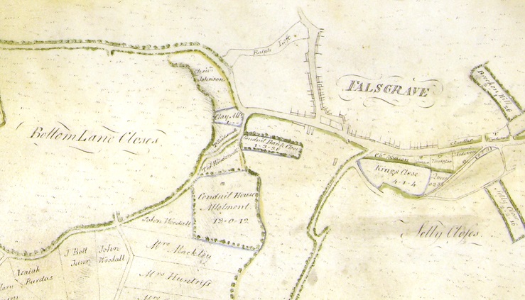
The springs were tapped by means of two well houses (or conduit houses - confusingly the term conduit has several meanings in the context of the Scarborough water supply); the first one of 1319 and the second of 1339. An 18th century map shows this area as Conduit House Allotment.
Extract from 18th century map showing Conduit House Allotment and the possible well house itself
We carried out archaeological investigations into the small stone structure on the wooded hillside about halfway up Falsgrave Park in 2001 to try to date it.
It had long been thought to be one of the Franciscan conduit houses. The present building probably does not date back before the 18th century when the people of Falsgrave improved their own water supply, but the discovery of stonework next to the building suggests there was an earlier structure on the site.
No firm dating evidence was found, but we are convinced that the site is that of the springs which were tapped in 1319 by the Franciscans. In 2005 we discovered the later well house much lower down the slope - there is a brief report on this on this web site - Falsgrave Park Lower Well House - Summer 2005
The conduit house contains a stone cistern. What we did not investigate in 2001 was how the water was collected to provide a consistent supply to the town. It was assumed, however, that a series of channels would gather the water from the various springs and direct it towards the well house where it would collect in the cistern and then be piped away to the town.
There is no obvious evidence on the ground for these channels, however in summer 2013 I located a shallow linear depression which I thought might be one of them since it aligned with some springs and the back of the well house. As a small Friends of Falsgrave Park project a trench was put across this line. This proved negative due to excessive ground disturbance by tree roots and ground slippage. However it was then decided to put down a trench immediately behind the well house itself with the help of some of the Parks staff and Chris Evans and Mick Panton of the Society.
This trench revealed the channel which directs water into the well house.
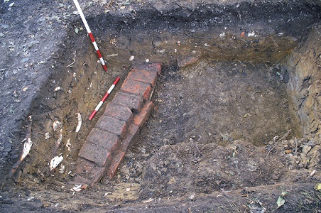
Looking down on the exposed inlet channel form the west showing its construction
Its construction is interesting. We removed three of the capping bricks and from this it will be seen that the end of the channel nearest the well house ie right of the photo consists of a carved stone channel with the brick capping
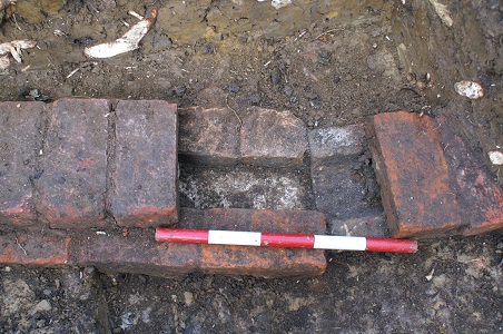
Exposed inlet channel following the removal of some of the capping bricks - carved stone channel on the right, closest to the well house. Flat stone ‘floor’ to the left
Further away the channel has a stone floor, brick sides and the brick capping. There is a slight dog leg in the alignment. This suggests that the channel had been subject to later modifications after initial construction in the 18th century.
The capping bricks furthest from the well house are 19th century. We removed one of the side bricks and this revealed that the stone ‘floor’ consists of thin limestone slabs similar to medieval and late medieval stone roof tiles - probably quarried in Forge Valley.
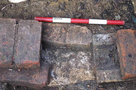
Exposed inlet channel following the removal of one of the side bricks showing more of the flat stone ‘floor’
This brick channel is clearly not the medieval supply (though medieval pottery was found); it probably dates from the 18th century improvements to the Falsgrave water supply, with later 19th century modifications.
The way the Falsgrave well houses and wells operated remains a puzzle. Given the build quality of the upper well house (the stone work is really good using a stone not found in the immediate vicinity, probably from Cloughton) it is surprising that there was only one inlet channel - it was a lot of effort to go to for the collection of a relatively small amount of water. Were there more channels in the medieval period? Was there yet another cistern further up the slope? Also, why not build the well house closer to the spring rather than on a spur? We need to do more research such as trying to find the actual spring to help us better understand the water management system.
Another enigma is how does the water get from what is now Falsgrave Park to the old town? There are references to a stone channel, but there are too many rises and falls in the land to make a direct route to the town a straight forward solution. Again we need to do more research.
Text & Images - Chris Hall
Back To Top
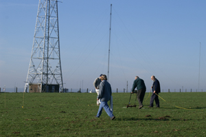
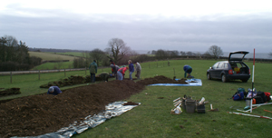
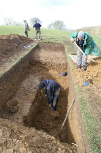
Field to the East of Raven Hall Road, Ravenscar
In March 2012 the Staintondale and Ravenscar Local History Group commissioned a geophysical survey of several areas at Ravenscar as part of their Ravenscar Barrow Project. The survey was carried out by James Lyall of the Landscape Research Centre and was funded by the North York Moors National Park through the Coast and Hills LEADER programme.
Five areas were surveyed. Four of these areas were sites of known burial mounds and are Scheduled Monuments. The fifth and most northerly site is the field behind the toilet block on Raven Hall Road which contained no previously known archaeological sites. However Knox, writing in 1855 refers to a barrow about ‘2 furlongs’ south of Raven Hall’ so there were references to the possibility of a barrow in this field.
The geophysics in this fifth site actually proved to be the most interesting. In particular the survey suggested the presence of two apparently superimposed features anomalies to use the geophysics expression – two conjoined semi-circular features about 13 metres in diameter (red on the plan below) and a possible rectangular enclosure about 25 metres across west-to-east (yellow on the plan below) - no northern limit was detected. A further circular anomaly about 80 metres to the south east (orange on the plan below) was also of interest.
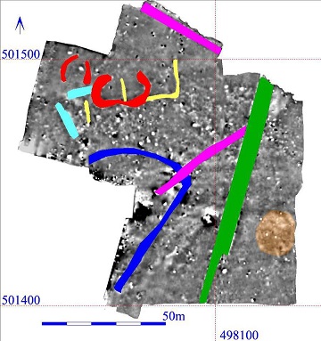 The geophysical anomalies, reproduced from the report by the Landscape Research Centre ©
The rectangular anomaly was particularly intriguing in the light of the discovery at Ravenscar in 1774 of a stone block with a Latin inscription recording the construction of a “tower and fort”. This is generally accepted as evidence of the presence at Ravenscar of a Roman “signal-station”; part of a coastal defence system constructed c AD 370 which includes sites at Huntcliff, Goldsborough, Scarborough and Filey. The stone was found by workman digging for the foundations of Ravenhill Hall – now the Raven Hall Hotel, some 200m north of the present site.
The Staintondale and Ravenscar Local History Group asked us to help them with our expertise by carrying out trial excavations to test the geophysics in this field. In mid November 2012 eight SAHS members and four Staintondale and Ravenscar members excavated three trenches (later expanded to four) - Trench 1 tested the circular feature, Trenches 2 and 4 tested the rectangular enclosure and Trench 3 the circular anomaly. Other than a 19th/early 20th century drain or similar feature crossing Trench 2, no archaeology was found.
In all three trenches the plough soil came straight down to the natural surface. The natural surface was a complex – in Trenches 1, 2 and 4 it consisted of angular broken sandstone pitched at varying angles which we think is an area of decay and natural disturbance at the interface with the solid geology which would have occurred as a result of periglacial activity. The natural in Trench 3 was more sandy but also thought to be periglacial. The features shown in the geophysical survey are therefore geological rather than archaeological. Although it is disappointing that no archaeological features were found the results are nevertheless of interest.
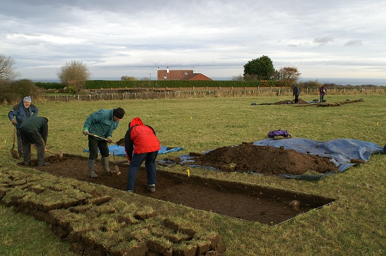
General view of the site showing the excavation in progress
Further examination of air photographs has shown the presence of a further circular feature near the southern boundary of the field. We therefore propose to excavate a further trench in Spring 2013 to test this feature.
Text - Chris Hall
Photograph - Chris Hall Geophysics Interpretation Plan - © The Landscape Research Centre
Download the report
Back To Top
Archaeological Investigations at 60 - 62 Quay Street Scarborough
A link to the Interim Report is available by click here. (** Updated 17/08/2020 **)
During the periods 16 September to 25 September 2011 and 1 June to 4 June 2012 the Society carried out archaeological investigations within a group of buildings on the north (landward) side of Quay Street, towards its eastern end.
No 60A Quay Street is two storey at street level built in Scarborough orange/red common brick, with recessed upper floors, whilst 60B, which is of the same build is single storey at street level again with recessed upper floors. This building was erected in the early part of the 20th century replacing a pair of small cottages of which little or no trace was found during the excavation although the Building bye-law drawing reproduced below shows a two storey cottage with a steeply pitched roof suggesting an 18th century building The present building was a warehouse or workshops. To the east of 60B is number 62 Quay Street which is three storeys on the street frontage and is a little older probably built in the last quarter of the 19th century possibly as a sail loft or net store.
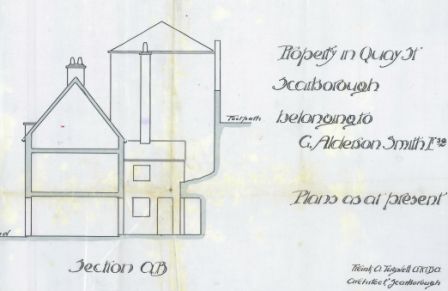 Extract from the Building bye-law drawing showing the previous cottage on the site and its relationship with the retaining wall to Burr Bank [reproduced by permission of Scarborough Borough Council]
At the back of the site is a huge retaining wall below Burr Bank and whilst number 62 butts up to it, number 60A/60B stops short with a small yard separating the wall from the building thus allowing the construction of the wall to be seen.
The archaeological investigation was carried out in advance of the possible re-development of the site.
Trench 1 was carried out in September 2011 in 60B Quay Street and measured 1.5 by 5.8 metres ie about 25% of the floor area of this part of the site.
The very northern end of this Trench ie the first 1.4 metres from the northern edge almost immediately came down on to natural clay some of which showed signs of natural re-deposition during the process of cliff slumping. Some of the cisterns referred to below had been cut into this clay. This clay had been levelled off to form a platform for building probably during the early 18th century and at this time the stone retaining wall which forms the northern boundary of the site seems to have been underpinned.
The upper parts of this trench revealed some brick structures which were interpreted as 19th cisterns surrounded by a fill of a similar date. Below this down to a depth of between 1.5 and 2 metres were layers of sand which had clearly been tipped and which contained a mixture of medieval pottery (some of it water abraded) and post medieval pottery. There were substantial quantities of furnace slag although no evidence of a furnace or forge was found. This sandy stratigraphy was interpreted as deliberate dumping in order to make up the land in the post medieval period. This confirms that in the medieval period there was no road along this part of what is now Quay Street – in other words the quay frontage was not continuous between the main part of the harbour and the landward end of the pier. John Rushton reports that the documentary evidence bears this out.
 The spring or well with its brick lining
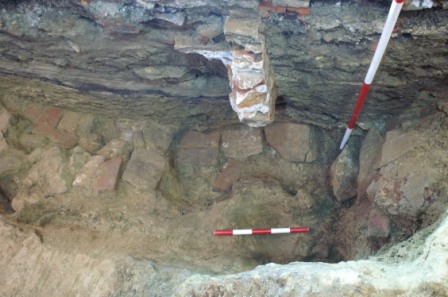
At the north end of the trench below the sand was a brick lined saucer shaped feature shown in the photograph above containing a thin layer of organic material. We think this is associated with a spring or well in the cliff face and the brick layer may be a ‘hard-standing’ to aid the filling of barrels to supply ships with water – however we need to expose more of this feature.
Trench 2 was carried out in June 2012 in 60A Quay Street. This trench measured 1.6 by 4.5 metres which is about 20% of the floor area of this part of the building As with Trench 1 the northernmost 1.3 metres were levelled off natural clay. In this case however the clay was retained by a large stone wall. To our surprise given that no such feature was found in trench 1 nearby, the south of this the trench revealed a cellar which had been in-filled by pushing the previous cottage into it. The bricks recovered from this cellar confirm an early 18th century date for the cottages. The infilled cellar was 2.2 metres deep, with a floor of stone slabs built off naturally deposited beach sand.
We intend to monitor and record the foundation construction particularly immediately abutting the Quay street frontage where there may be either a wall to retain the dumped sand or the footings of the former cottage.
 The stone retaining wall, cellar fill and cellar floor in trench 2
Text - Chris Hall
Photograph - Chris Hall
Back To Top
Land at the rear of 34 Queen Street, Scarborough - 2011
Here is a link to the full Fieldwork Report
34 Queen Street is a late 18th century building on the east side of Queen Street, about half way along. It is in an interesting area as in the medieval period the site was within the precinct of the Dominican friary. Scarborough had three friaries. The Franciscans were where Friarage school now is; the Carmelites were on the east side of Queen Street about where Boyes’ store now is; and the Dominicans were also on the east side of Queen Street immediately north of the Carmelites. The exact boundaries of these sites are unknown at present.
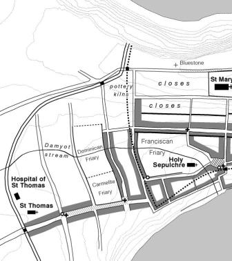
Extract from the map in The Archaeology of Medieval Scarborough showing the location of the friaries in Scarborough
Very little archaeological investigation has been carried out on the sites of these Friaries and so the opportunity to carry out investigations on the land at the back of 34 Queen Street was fortuitous. We worked here in March and April 2011.
We had hoped to find some physical remains on the Dominican friary. Two trenches were put down, one measuring 5 metres long was adjacent to the east boundary wall whilst the other was close to the building and was 3.8 metres long. Both trenches revealed that the medieval deposits had been removed down to a depth of between 1.8 and 2.2 metres where natural clay was encountered. It seems that as on other sites which were vacant in the post medieval period, the ground had been stripped and the clay quarried away, possibly for brick making – see the report on Auborough Street. Some circumstantial evidence was found of the Dominican Friary in the form of architectural fragments in the re-deposited fill. These fragments included glazed floor tiles, stone roof tiles, window tracery and cylindrical stone fragments which are thought to be colonnettes - a small, relatively thin column, often used for decoration or to support an arcade for example around a cloister.
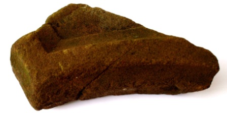 Fragment of window tracery
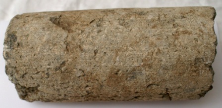 Fragment of colonnette
The stone used for the colonnettes is interesting as it is a pisolitic limestone; a sedimentary rock made of pisoids, which are concretionary grains, approximately spherical and which would give the polished surface of the colonnettes an interesting appearance. This stone does not occur locally; it may have come from as far away as Devon.
Text - Chris Hall
Photos - Chris Hall
Map - Trevor Pearson
Pre-historic square enclosure at Racecourse Road/Seamer Moor, Scarborough - 2009
Here is a link to the full Fieldwork Report
Our work carried out at this site in 2008 is described below
We revisited the site over six days between 25 September and 4 October 2009 to carry out further ground investigations. The purpose of these investigations was to test the results of the geophysics and to explore the interior of the enclosure. Six trenches were excavated which were numbered 2 to 7 to follow on from the 2008 trench numbering.
Trench 2 was located towards the north west internal corner of the enclosure where an area of high resistance had been recorded. At a depth of about 150mm below ground level a surface of angular calcareous grit stones was encountered, the stones lying at irregular angles. This layer was sampled by excavating a 500 mm wide sondage, running north-south along the eastern edge of the trench. This revealed that the stony layer was only one stone thick and lay on a grey brown loamy material containing fragments of iron age pottery. The stone feature was interpreted as the base of the enclosure rampart overlying a decayed vegetation surface. It is probable that evidence of the rampart survived here due to the fact that it is close to the point where the enclosure turned through 90o – the rampart would therefore have been thicker. An environmental sample was taken from the decayed vegetation surface and this will provide useful comparison with the sample taken from the ditch in trench 1.
Removal of the rampart material at the southern end of the trench revealed further sherds of iron age pottery which could be the result of either pit digging or dumping refuse against the corner of the rampart.
1. Trench 2 viewed from the south showing the base of the rampart (context 2001) and the trench sampling the underlying layer to the right
Trenches 3 (near the centre of the enclosure), 4 (positioned in order to test an area of low resistance close to the south-east corner of the enclosure) 6 and 7 all encountered the natural calcareous grit at about 250mm below the present ground surface. No occupation evidence was found in these trenches
Trench 5
At a depth of between 200 mm and 230 mm below ground level, decayed calcareous grit was encountered, although it was pitched at much more irregular angles than elsewhere. The trench contained one post hole and socket consisting of seven vertically set stones around a hole approx 100 mm square cut into the natural and 100 mm deep. Excavation of this post hole produced two sherds of iron age pottery, although there was not an occupation layer associated with the post hole, this probably having been removed by ploughing.
 2. Trench 5 viewed from the west showing the natural decomposed stone surface and the stones forming the sides of the post hole
The radiocarbon dating of the organic deposits from the ditch excavated in 2008 firmly placed the date of the ditch in the late Iron Age. The structure was therefore not created as a Roman fort and there is no other evidence to support Hinderwell’s assertion that it was used as a Roman defensive earthwork either on its own or as part of a series of forts.
The plough soil in all the trenches contained modern pottery mostly 19th century and early 20th century, the presence of which was thought to be the result of the import of refuse material on to the land. Below the plough soil the dating evidence points to occupation in the Iron Age. To date no evidence of later occupation has been found and it is likely that if there were any it has been destroyed by ploughing. The results of the environmental analysis will provide further valuable information since the sample taken in 2008 from the ditch material represents a period when the enclosure was in use, whereas the latest sample from the relict vegetation surface will reflect the pre-existing conditions. It is hoped to carry out further work in the area of Trench 2 in 2010 to provide more evidence about the site and its occupation.
Text - Chris Hall
Images - Chris Hall
Back To Top
Scarborough Marine Engineers
The Society undertook excavations within the building previously used by Scarborough Marine Engineers between November 2008 and February 2009. The building is a large, mid 2oth century structure which fronts Sandside and extends back right through to Quay Street, four trenches were opened (Trenches 1,2,4 and 5). "Trench 3" relates to the recording of structural evidence revealed during building work to the south of the Marine Engineers. In total the trenches opened covered an area of 35 sq m, some 10% of the total interior area of the building. In several places it was necessary to excavate to a depth of c 2.5m below the present concrete floor.
Before commencing work a Project Design was prepared which set the objectives for the work which were that were intended to determine the nature, depth, extent and state of preservation of archaeological deposits on the site and , more specifically, to test :
• the survival of the remains of the (presumed) late medieval timber building ("Crazy Cottage") known to have stood on the south side of Quay Street prior to the construction of the Marine Engineers; and
• the possible alignment of the later medieval sea wall.
1. The foundations of ‘Crazy Cottage’ in trench 1
Trench 1 was opened in the NW part of the building and successfully located the linear foundations of stone boulders which supported the timber frame of Crazy Cottage. Trench 2 was opened to the south and east of Trench 1 and was sited across the line of a distinct rise still observable in the nearby alleys linking Quay Street and Sandside. It was thought possible that this rise might mark the line of the medieval sea wall.
2. The drain in Trench 1
Below the late medieval foundations in Trench 1 and throughout Trench 2 was a massive dump of soil, c2.5m deep, representing a major episode of land reclamation in the late medieval period. Incorporated within the reclamation was a well-constructed stone-lined drain running north-south. The excavations suggested that the rise in the modern ground surface is a reflection of a pre-existing dune system of which the reclamation took advantage.

3. Trench 2 showing the sand at the bottom of the trench possibly due to dune formation
As it was clear from Trenches 1 and 2 that the later medieval sea wall which retained the reclaimed land must lie to south a small trench (Trench 4) was opened at the southern end of the site to see whether the medieval dumping extended all the way to the present Sandside. This proved not to be the case, post-medieval (?16C/17C) infill being found all the way down to the underlying sand.
A final trench (Trench 5) was therefore excavated to the north of Trench 4 , linking it to Trench 2 and thus providing a complete North-South transect across the site from Quay Street to Sandside. This trench located the approximate position of the medieval sea wall which had at this point been entirely robbed out, presumably so that the stone could be re-used in the post-medieval sea wall further south. One massive stone block was found in the underlying sand where it had probably fallen prior to the demolition of the earlier sea wall. The robbing "cut" and the area to the south was filled with dumped soil containing 16C - 17C material. Sand was again encountered at c 2.5m below the present building floor.
4. Trench 5 showing the location of the robbed out Quay alignment represented by the curved cut
Full analysis of the finds is still being undertaken. Significant quantities of pottery were recovered from both the principal phases of land reclamation. The earlier phase of dumped material included a high proportion of Scarborough ware (including knight jugs) and Staxton ware, suggesting a fourteenth century date. Pottery from the later phase of reclamation to the south appeared to be of sixteenth or seventeenth century date. The pottery awaits further analysis.
Anaerobic conditions within the soil dumps in some parts of the site led to the preservation of wood and leather objects (the latter principally shoes). Samples of the organic material were taken and are being analysed by Paleoarchaeolgical Research Services Ltd. Also preserved, primarily in the later contexts, were strands of fibrous material interpreted as caulking for the seams of boats. Other evidence for shipwrighting in the vicinity was provided by iron and timber nails, quantities of iron slag and a (possible) pitch pot.
Building materials were present throughout and included both limestone roofing and clay tiles. Quantities of heather recovered from anaerobic contexts may also indicate the use of this material as a roof covering. The site also yielded quantities of animal bone.
Our work has benefitted from the input of Dr Brian Sweeney of Hull University Scarborough Campus who has suggested that the sand deposits were wind blown and represent a phase of dune formation - which would have had implications on the way the harbour operated.
The excavation revealed two major phases of land reclamation adjacent to Scarborough harbour. The former, assumed to date to the fourteenth century, was clearly a major engineering exercise, creating what was effectively a new maritime suburb to the town on the south side of Quay Street.
Overall a good understanding of the archaeology within the Marine Engineers site was achieved. However, when the site is developed it may be desirable to machine-dig a trench under archaeological observation to the west of Trench 4 in order to confirm the line of the medieval sea wall.
Text - John Hinchliffe (mostly) and Chris Hall
Images - Carl Racey (picture 1) and Chris Hall (the rest)
Back To Top
A Pre-historic square enclosure at Racecourse Road/Seamer Moor, Scarborough
This rectangular enclosure has been known for some time and has been of interest to Chris Hall and Trevor Pearson for a number of years. During 2008 we had our first opportunity to carry out ground investigations on this site.The site had been assumed to be Roman largely on the basis of its shape and references to it by the antiquarians Thomas Hinderwell, George Young and Robert Knox and also by the Ordnance Survey.
Here is a Google map of the site: zoom in to examine the field in detail
View Larger Map
The site occupies a small spur of elevated land to the north of Racecourse Road/Stepney Hill, and around which the road, rising from Scarborough, curves on the south and east. This spur of land was enclosed on the west and north by a double ditch, though the greater part of this has now disappeared. The spur, on its east, forms part of the scarp slope of the eastern outliers of the Tabular Hills making this quite a prominent site. From the descriptions by antiquarians, referred to above, and from the evidence of the 1854 and 1893 large scale Ordnance Survey maps the site is known to have been occupied by a square enclosure consisting of ditch and bank or rampart but since the second half of the 20th century there have been no significant upstanding earthworks. However, an aerial photograph taken in the winter of 1999/2000 ( see www.getmapping.com) just after the western field had been cultivated reveals the greater part of the enclosure as a clear soil mark indicating that there must still be some sub surface survival of the feature. No obvious features within the enclosure appear on this air photograph.
Ground investigations commenced in February 2008 with non-invasive survey. A magnetometry survey was carried out using a Geoscan FM256 fluxgate gradiometer and a resistivity survey using a Geoscan RM15-D resistance meter on a 100 metre by 60 metre grid - this work proved inconclusive as did the field walking carried out simultaneously.
1.Geophysical survey in progress
Ground intervention carried out over the period 15 to 20 March 2008 consisted of a single trench located over the predicted alignment of the ditch and bank forming the northern side of the enclosure.
2.General view of the excavation showing the position of the trench in relation to Racecourse Road
Initially the trench was 20 metres long by 2 wide, but it was extended by a further 2 metres at a width of 4 metres in order to pick up more of the enclosure. This trench revealed the presence of a substantial ditch cut into the natural rock. This ditch had a width at its top of 4.7 metres reducing to about 0.8 metres at its bottom - it was not possible to fully excavate the bottom of the ditch due to adverse working conditions. The depth of the ditch was about 2.3 metres. There was no evidence of the associated bank.
3.Excavation of the ditch in progress
There was very little dating evidence although close to the bottom, three sherds of pottery were found which have been tentatively dated as late Neolithic or early Bronze age. This clearly has a major implication on the dating of this feature and to provide further evidence the Society has now funded radio-carbon dating of charcoal samples taken from the same vicinity as the pottery. Environmental sampling was also carried out and again analysis of this material is being carried out. The results of these scientific studies are awaited.
4.The fully excavated ditch
We hope to carry out more work at this site including geophysical survey to try to determine whether the enclosure was occupied and its exact size. We also hope to investigate associated structures in the surrounding area.
Text and Images
Chris Hall
Back To Top
Auborough Street - Scarborough: recent and future work
During May and June 2007 a research excavation took place in the garden of T L Chapman's premises off Auborough Street. It is possible that we will carry out further work on adjacent land in the near future to add to the work done in 2007. Over the last 20 years we have carried out 69 excavations or watching briefs and put down about 100 trenches in the town. This represents a major body of work, of which we can be justly proud. Many of these have been small scale works and many of them have been development led where the agenda has been governed by data recovery rather than answering specific questions. In 2007 we made a decision to move away from development led archaeology and to move back to doing fewer, but longer research led excavations - Auborough Street was the first of these.
The site at Auborough Street was of immense interest to us. It is shown on John Cossins’ 1725 map as open land, and has remained as such ever since - it was probably vacant in the medieval period. Moreover the eastern boundary of the site has persisted over this period meaning that it is significant. We thought this site could help us answer the question 'What is the course of the northern section of the Old Borough defences?' Trevor Pearson and Chris Hall postulated an alignment of the Oldborough defences which would take them (ie ditch, rampart and wall) on a more eastern course than that postulated by Peter Farmer. Maps and boundary analysis supported this thesis and this site off Auborough Street (behind Niso Terrace) was in the right place to answer this question.
5.General view of the site showing the excavation in progress
Three trenches were put down during this week long excavation - Trench 1 was against the boundary wall with the Mariners homes on Tollergate (the eastern boundary of the site) whilst Trenches 2 and 3 were on the grassed area in front of the house.
Under relatively modern overburden, the excavation of each trench found that the site had been quarried for clay in the post medieval period. The ‘quarries’ took the form of long narrow trenches separated by narrow clay baulks. We have found similar ‘quarries’ at Paradise and Tollergate. We think that they represent the systematic digging of clay, probably for brick or tile making, each ‘quarry’ being big enough to produce enough material for the firing of one kiln. After excavation of the clay the ‘quarry’ was backfilled and we think another strip was excavated leaving the baulk between avoid contamination of the clay.
6.The clay ‘quarries’ in Trench 2 clearly showing the baulks
7.The clay ‘quarries’ in Trench 3 showing the baulks. The diagonal features seem to be associated with the back filling of the ‘quarries’
Although it is disappointing that evidence of the alignment of the town defences was not found, the discovery of this further set of clay quarries is interesting. The represent valuable evidence of an economic activity which was taking place in the town which is proving more and more extensive. We are still working on the finds so we have not got dating for the ‘quarries’ yet. The excavation did also show that Peter Farmer’s postulated alignment of the Old Borough Defences was not correct and a second phase of work on the other side of the boundary wall may help to cast further light on this puzzle
8.Trench 1 showing the footings of the boundary wall
Text and Images
Chris Hall
Download the report
Back To Top
Field work at Wansford - Autumn 2006
In September 2006 the Society commenced field work at Wansford a small village a couple of miles south east of Driffield. This is the first time we have organised field work outside Scarborough for some years, although we have worked with other groups in the wider area. The site is a large field, which in 2006 carried a corn crop. Earlier maps show that the present field was previously divided into smaller units. We investigated this site at the request of Society member Sheila Cadman who lives in Wansford and who has found much Iron Age/Romano-British pottery and flints while walking the field.
An aerial photograph of 1975 (see below) shows a square enclosure appearing as a crop mark close to two clumps of trees. The northern clump of trees is a relic of an earlier field boundary and helps us tie in the site with the 1892 Ordnance Survey map where the boundary seems to respect the northern alignment of the enclosure. The southern clump is an oak tree which still exists. An earlier air photo of 1947 was taken in low winter light (17 November) and shows features as shadow lines. It looks like in 1947 the southern side of the enclosure was then an open ditch.
Extract from 1975 aerial photo showing the enclosure
When the new water treatment works were being built in the south east corner of the field in 2005 a geophysical survey was carried out. The enclosure showed up clearly on this survey although it was not continuous on the north, south and east boundaries. Areas of high ferrous content were also present. Associated excavations revealed evidence of a Romano-British settlement and field systems.
We put down two trenches. Trench 1 was located just north of the oak tree and picked up the eastern side of the enclosure close to, but not on, its the northern corner. The enclosure ditch was encountered here as a feature with a slightly different fill from the natural. It appeared that the ditch had been partly re-filled and re-cut. It also appears that there was a period when the ditch had become partly filled but the fill remained open leading to the fill surface being compacted. We were also interested in why the oak tree appeared to be on a mound but found no evidence to help us in this.
Work commencing in Trench 1
Trench 2 was L-shaped and designed to pick up the western and southern alignments of the enclosure, which it did it two locations as predicted. The southern ditch was partially sectioned. It had a much more loamy fill than in Trench 1 and the finds evidence appeared to be later.
We are currently analysing the finds from these excavations and hope to do more work here comprising:-
- Field walking tying in the finds using a GPS
Micro-contouringText and Images
Chris Hall
Back To Top
Quay Street, Scarborough - Autumn 2005
Over the turn of the year 2005 -2006 we carried out archaeological investigations at this important site in Quay Street. The excavation report will be available soon.
The site is at the corner of Parkins Lane and Quay St behind The Golden Ball pub. It is known to have been occupied until the 1920s by a 14th century timber framed house, which is illustrated in our publications A Guide to Historic Scarborough or, for more detail, The Archaeology of Medieval Scarborough. Latterly the site was occupied by a brick garage on a concrete base but this has now been removed.
23 Quay Street as photographed in the 19th century: the timber framing is clearly visible on the end elevation
The owner took off most of the concrete base under archaeological supervision and this showed the site was occupied by an infilled cellar which is consistent with what is at the Three Mariners along the street. Under archaeological supervision the owner cleared out the cellar of its fill and this showed that the wall alongside Parkins Lane was the stone base wall for the timber frame building which had existed above – this is an important survival. There was also a stone cross wall which seems to have been a partition wall within the building.
Following clearance of the cellar we were able to lift the floor a put down trenchers. One trench was at the back of the site against the brick cellar wall and the other flanked the stone cross wall. Both these showed that the cellar was built off sea sand which is what we also found at the Three Mariners. The sand contained medieval pottery of the 13th or 14th centuries which would be consistent with the date we think the timber frame was. Although the pottery was in the sea deposited sand, it was not water worn showing that it had been dumped not long before the building was put up – perhaps the sand was added to give a level base.
A large amount of iron was found and we think some industrial process such as nail making went on here.
Finally in the south west corner there was much later structure which we think was for boiling crabs.
Text and Images
Chris Hall
Download the report
Back To Top
Falsgrave Park Lower Well House - Summer 2005
As part of the Falsgrave Project, investigations are being carried out, with help from the Friends of Falsgrave Park, into a structure in the north-east corner of Falsgrave Park.
The structure we have uncovered is built in brick with an arched roof, although the arch was partially demolished a few years ago (this has actually helped us get into the structure). It was rumoured that the structure was an ice house or an air raid shelter but we were sceptical of these.
The building contains two cisterns, divided by a low brick wall. There is an inlet conduit in the western wall which is of two phases and a lead pipe leads out at the east end. During recent heavy rain the conduit was flowing and the cisterns filled up.
The area now occupied by Falsgrave Park was important to the development of the town – it was where in the 14th century the Franciscan friars tapped the springs to provide a water supply.
There were two ‘Franciscan Springs’ or well heads. We think the small stone building at the top of the Park was on the site of the second of these, dating from 1339 and that the brick building we have uncovered is on the site of the first Franciscan Spring of 1319. The thin bricks seem to be of 17th century date and this would be consistent with documented improvements to the water supply made in the first half of the 17th century. The lead pipe would date from this period – but we think the stone floor is much earlier and is possibly a fragment of the original 1319 Spring Head.
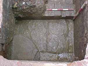
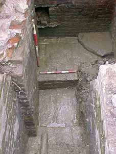
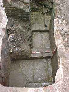
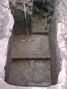
Text and Images
Chris Hall
Back To Top
The Pentecostal Church - Easter 2005
*** Updated 23/11/2022 - A copy of the report can obtained by clicking here.
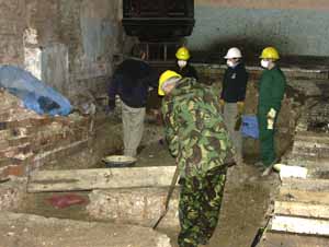 Over the Easter weekend the Society carried out an excavation inside Scarborough's disused Pentecostal church which is awaiting redevelopment. Initial comments on the dig from Trevor Pearson:
Medieval features consisted of two interconnecting gullies at the south end of the site (the end furthest from the door). These were only around 0.1m deep and contained traces of small timber posts in the form of organic stains. There was also a larger posthole. Most likely these gullies mark the position of two interconnecting fence (or perhaps a small timber building) in the back yard of a medieval house fronting on to St Sepulchre street.
Why didn't we find more medieval remains? Well, it looks as though the site was leveled when the Pentecostal Church was built in the 19th century. This is probably when most of the medieval remains on the site were destroyed.
However...... if there had been any medieval pits on the site like those we excavated on the outside of the church in 2003 some traces would have survived, but we found nothing. This is significant and must mean that by crossing from the outside of the church into the interior we have moved into the back yard of a different medieval property. Evidently, none of the medieval owners of the property now occupied by the Pentecostal Church bothered to dig pits in their back yard!
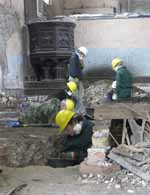
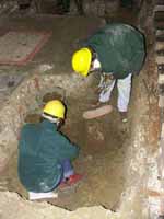
The only other features we found are post-medieval and consist of a large oval shallow pit at the north end of the site (the end nearest to the door) which could have been a tree hole or the base of a garden feature when this part of the site was open ground, .....or it might have been to do with the building of the Pentecostal church or the previous chapel on the site. In other words, we don't really know what the pit was for!
We also found a large area had been dug away along the east side of the site and filled with loose soil. We suspect this is where burials have taken place in the 18th or 19th century associated with the church or the earlier chapel.
In summary then, though most of the medieval deposits appear to have been destroyed 150 years ago, comparison of the 2003 excavation and the present dig indicates that the east side of the Pentecostal church is on the line of a medieval property boundary. This is the first time we have been able to prove the continuity of a property boundary from medieval times to the present in Scarborough using excavation evidence.
It is disappointing that more did not turn up given all the hard work put in to digging out the trenches, but it has still provided useful evidence.
Text
Trevor Pearson
Images
Nick Kemp
Back To Top
Friargate, Scarborough - 2005
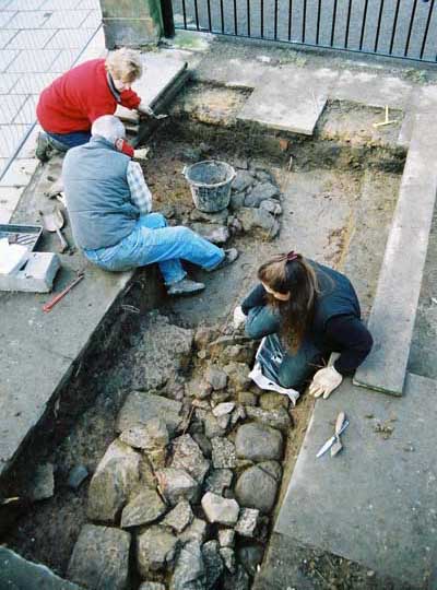
The Society recently commenced a research excavation on a piece of open ground near to the playground of Friarage School, opposite the Public Market Hall. The site is of particular importance as it is close to, or on the line of, the old borough defences which consisted of a moat, with rampart and wall behind. The alignment of the town moat was located in 1989 at 1-3 Leading Post Street, which is on the opposite side of St Sepulchre Street to the present site. It is thought that there may have been a gate through the wall at this point.
Additionally, the site now occupied by Friarage School was once occupied by the Franciscan Friars. Very little evidence of their friary has been found.
It is hoped that the excavation will cast further light on the alignment of the town defences; or on the precinct of the Franciscan Friars; or on what type of settlement activity there was behind the town wall.
Text
Chris Hall
Back To Top
The Springfield Excavation - 2004
This is a site where the Society was very active in 1997-1998. We re-visited starting with a full week during February 2004 and then over several long weekends until July. Our work was in advance of the building of more houses. We excavated six trenches.
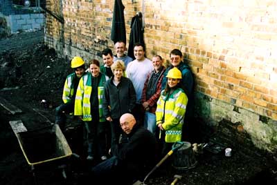 Some of the excavation team
Trenches 12, 13, 14, 16 and 17 were put down close to previous Trench 10 to further investigate the known archaeology in the lower area. We particularly wanted to investigate the size and width of a known north-south wall and the extent of survival of a paved area. In trenches 12 to 14 what we found, working from east to west, were a stone cobble surface; a wall; a stone slab surface the same as in former Trench 10 and another wall previously discovered in Trench 10 To the west of the wall a rubble cross wall and a loamy deposit containing entirely medieval pottery were revealed.
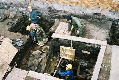
At work in Trenches 14 (back) and 16
In Trenches 16 and 17 we found a much more complex series of features comprising the same wall and slabs. Below the slabs were a further series of slabs, a wall drain and a spreader foundation to the wall which was of very substantial construction standing nearly 2 metres high. A ‘cistern’ was found to be inset into the floor. Trench 17 contained a further wall at right angles to the wall in Trench 10/16 and a substantial stone structure tentatively interpreted as a buttress. Clearly there has been a very substantial series of buildings on this site whose function we do not yet understand – they may be related to the nearby Franciscan Friary; to the milling which is thought to have taken place on the site or to an industrial or commercial use. We do not know which parts of the structure represent the inside of a building and which the outside.
Trench 15 was put down on the upper level of the site. Unfortunately the size and location of the trench was restricted due to use for off-street parking – ideally the trench should have been larger and a further trench put down.
We found two phases of stone wall, separated by a layer of clay. The upper phase was interpreted as being a wall associated with the almshouses, Taylor’s Free Dwellings, which existed on the site. The lower wall was found to be sitting on a mid brown loamy clay containing entirely medieval pottery and interpreted as a relict ground surface upon which the wall sat.
Palaeoecology Research Services have carried out environmental analysis of the organic material from Trench 16 thanks to funding from the Local Heritage Initiative.
We are currently carrying out analysis of the finds from the site (including 43kg of pottery) and hope to publish our report soon.
Text
Chris Hall- Director, Springfield Excavation
Images
Geoff Wood
Back To Top
Get involved - now!
If you are interested in getting involved in fieldwork, contact Chris Hall by e-mail fieldwork@sahs.org.uk
See the excavations database to find out about excavations carried out over the past 20 years.
Individual reports are published on many excavations. See the publications page for more information.
To find out about current fieldwork contact the Scarborough Archaeological and Historical Society's Projects Officer:
Chris Hall
Projects Officer
Scarborough Archaeological & Historical Society
4c Dunslow Court
Eastfield
Scarborough
YO11 3XT
email: fieldwork@sahs.org.uk
Back To Top